 poster courtesy of Damaris Brisco, learn more
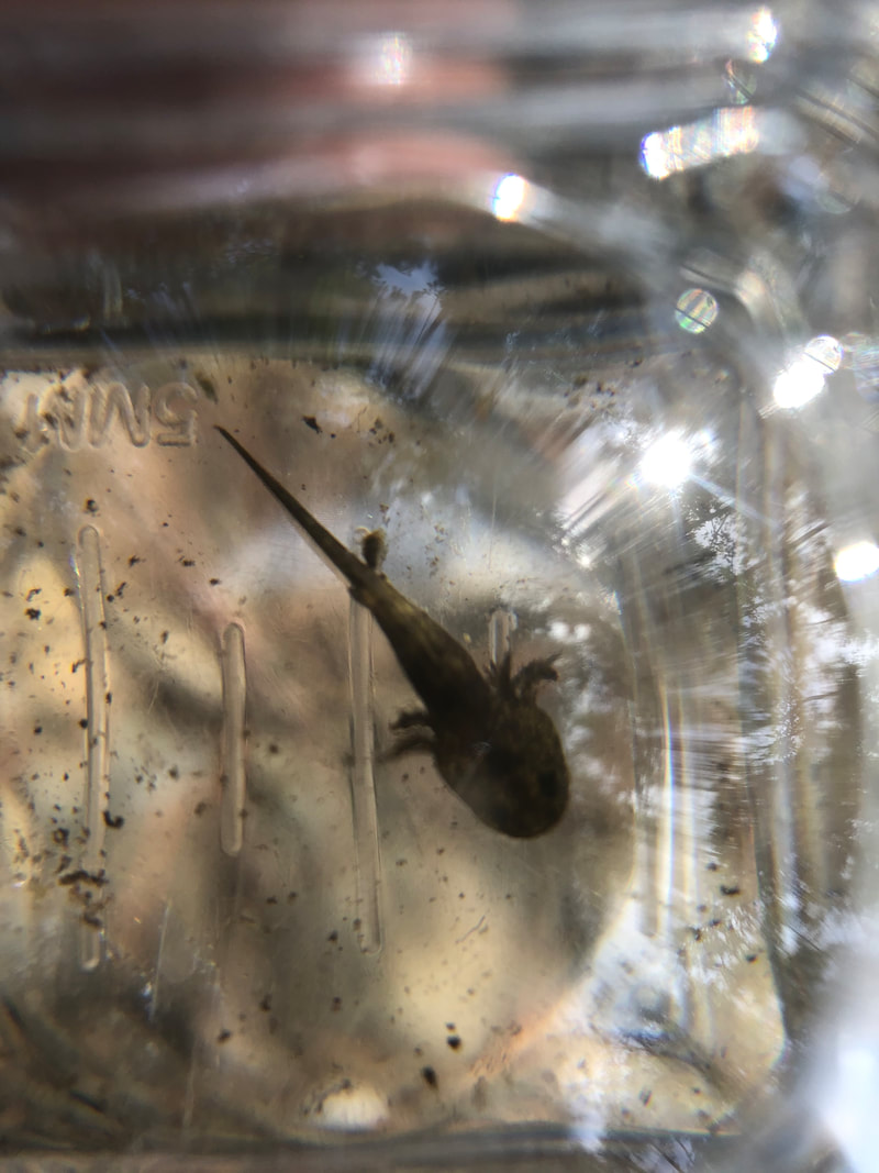
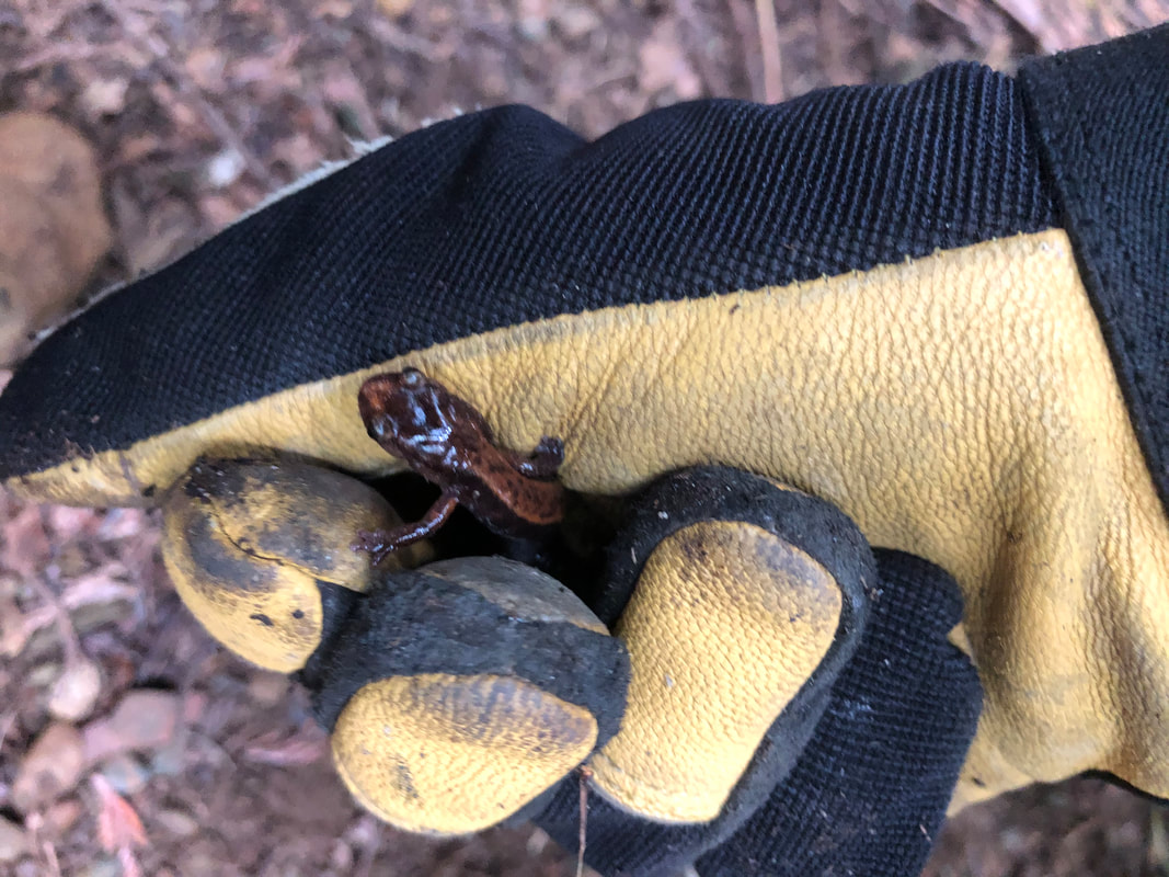
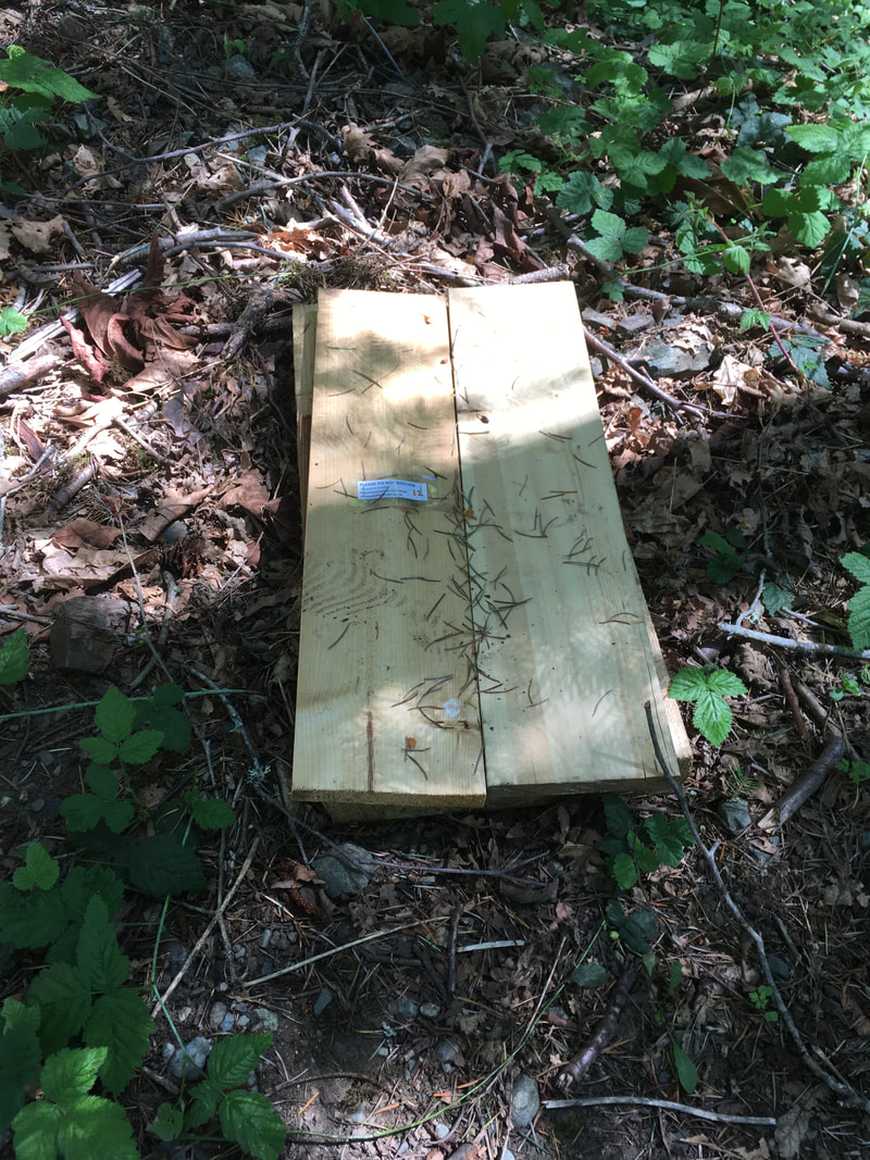  May 2021, nursery for long-toed salamanders
0 Comments
Volunteers from Walley Creek and Departure Creek Streamkeepers pulled off a small project in the "salmon window", so that we could follow Covid protocols.
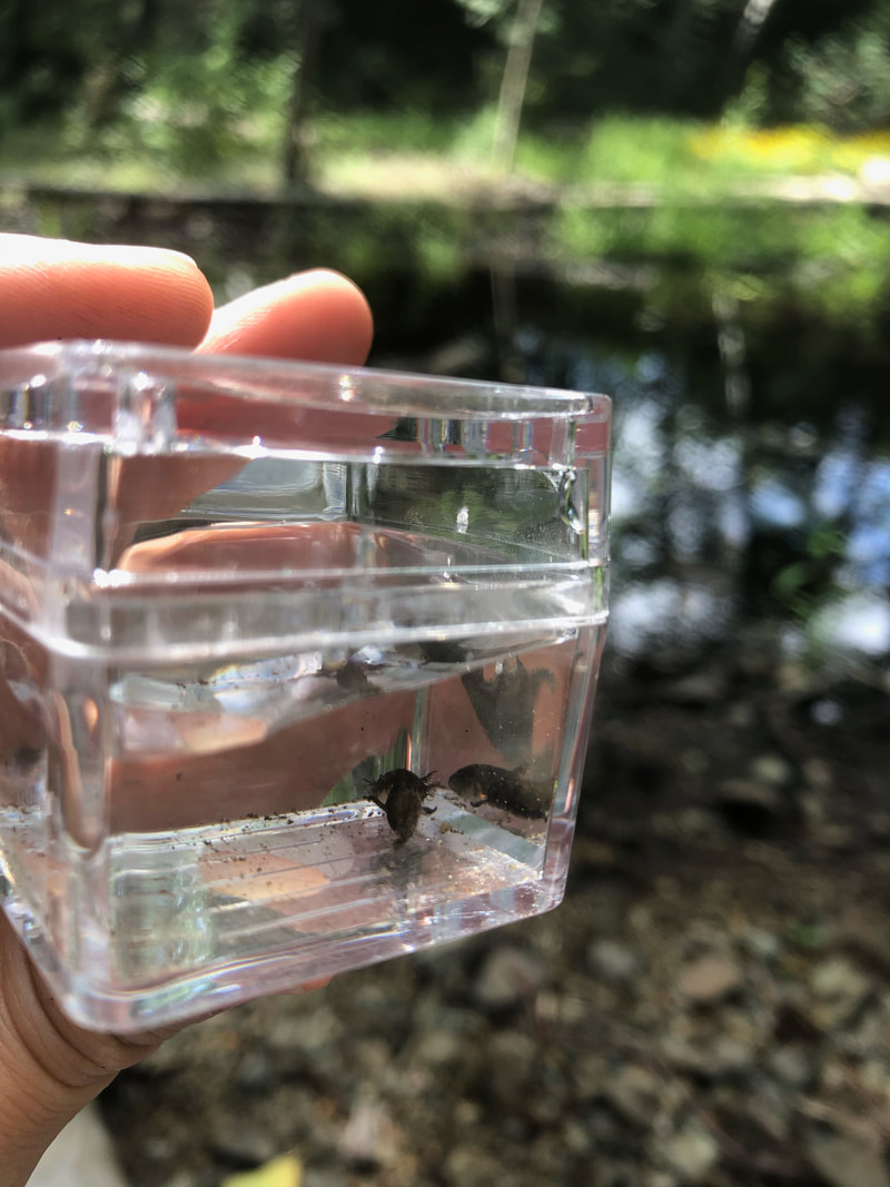
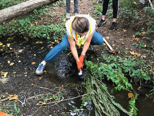
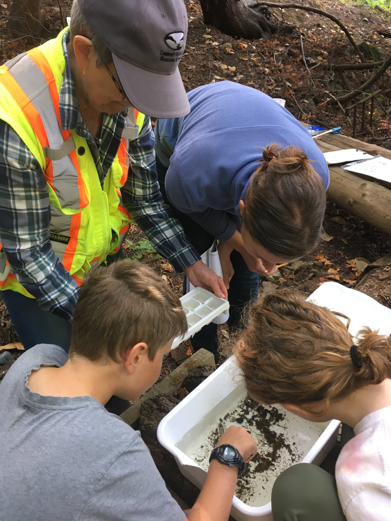
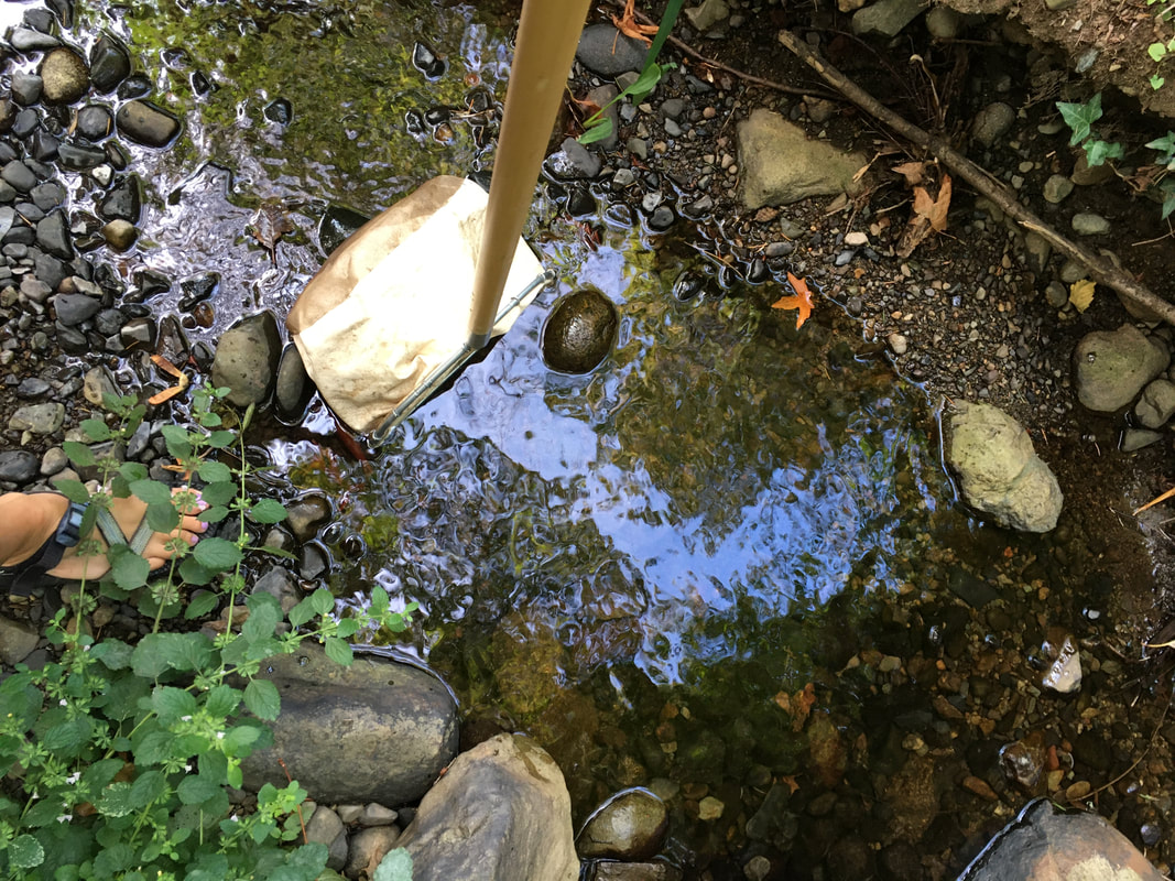
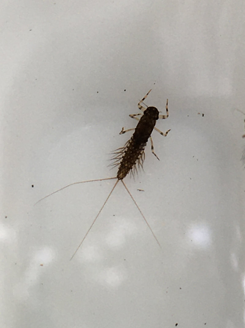
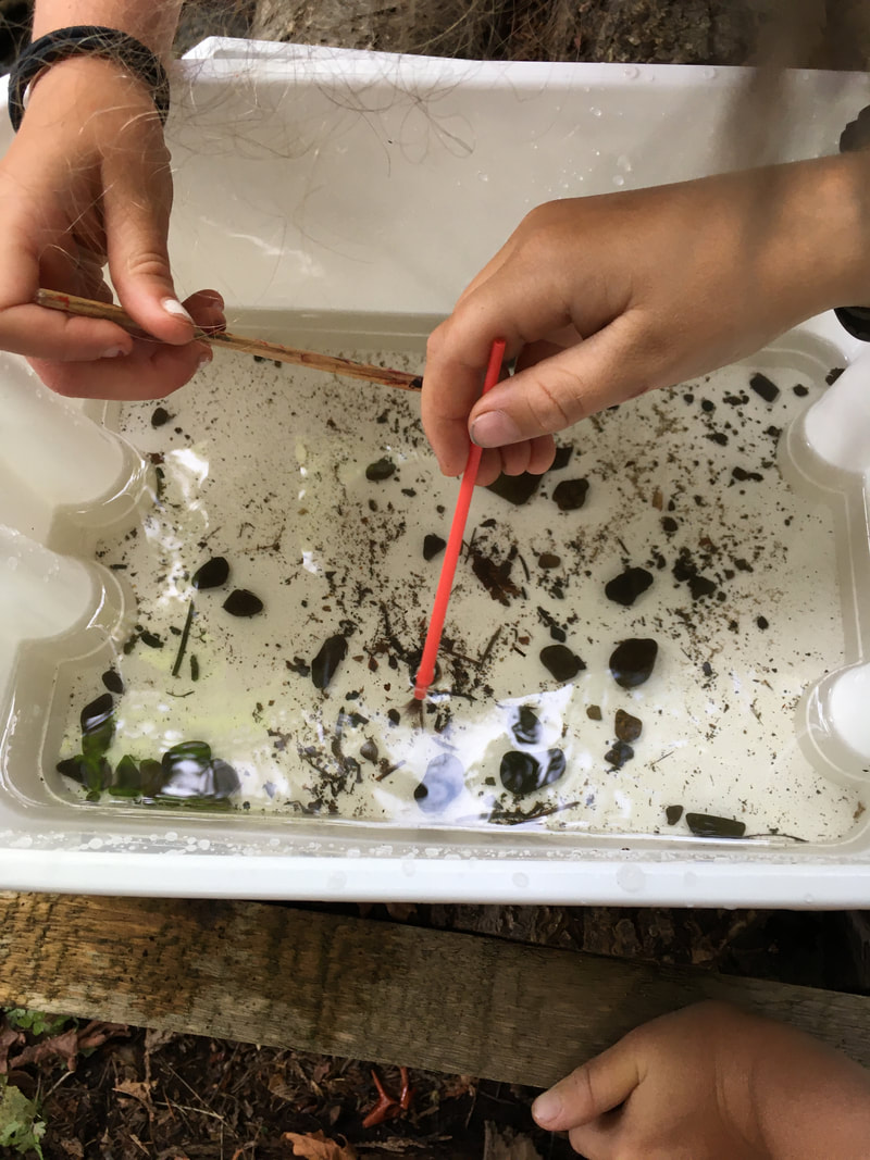
 Today we did an invertebrate study at our lowest monitoring site on Walley Creek. We haven't sampled for inverts since a Junior Streamkeepers Day with Dave Clough in 2017, but we read over Module 4 of the Streamkeepers manual and even checked out the Pacific Streamkeepers Federation YouTube page to get ready.
We sampled three times and found many mayfly and stonefly larvae, which are both intolerant to pollution. So, the presence of these fragile organisms in the creek means the water is clean and clear, with sufficient oxygen for aquatic life. It was exciting to find these important little insects!
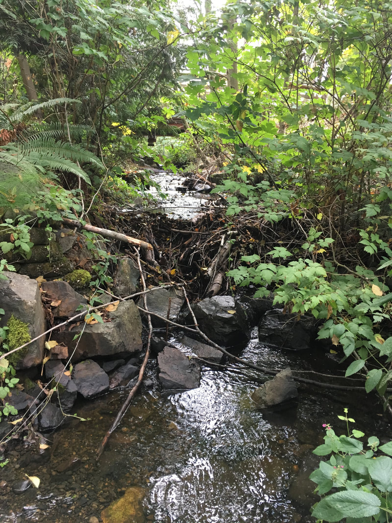
There is nothing more heartbreaking to a Streamkeeper than seeing a stream disappear. During the summer of 2019, we were dismayed to see Walley Creek go subsurface below Shores Drive. This impacted our water quality monitoring (no water, no data!), and we assumed would have a disastrous effect on the trout and aquatic invertebrates in those lower reaches. We contacted the Province (Ministry of Forests, Lands and Natural Resources, Water Protection Branch) for assistance, and were put in touch with regional hydrologist Neil Goeller to learn about flow monitoring opportunities. He suggested setting up a trail camera and flume + pressure transducer somewhere around our lowest water quality monitoring station near Morningside Drive to compare stream flow with rainfall. The RDN also gave us permission to set up a trail camera and flume + pressure transducer where the creek flows through the GNPCC property. Neil suggested the flumes would be most useful to measure summer (low) flows. In the winter we would have the option of using a FlowTracker2 to take measurements, or just taking photos and measuring depth. Flow monitoring data gets uploaded to the Provincial database, and the longer you have been recording data the better. Neil said 10 years is good, 20 years is great. We want to better understand the floodplain dynamics and flow regimes along the whole length of Walley Creek. Basically Neil's advice was - understand what's there so we can look for opportunities to improve green space/habitat/water retention.  Two flow monitoring stations were set up in late August 2019. By September the lower flume kept over-topping during large rain events, even after Neil replaced it with a larger one. He suggested that we switch to taking periodic discharge measurements with a flow meter and staff gauge (think ruler). He noted that the creek seemed to go dry a few days after a rain event in September, so he wondered about simply noting presence/absence of water since the most pressing question was of continuous flow (or not). In January 2020 Neil trained us on using the FlowTracker2, with the goal of comparing water levels (using the pressure transducers already installed) with flow. Gauging flows this way takes about 30 minutes each time, taking multiple measurements across the width of the creek, which Linda and Nina carried out from March until July 2020, when flows were too low to measure. The Mid Vancouver Island Habitat Enhancement Society (MVIHES) has published several reports (Dumont, J. 2017) on their flow monitoring of Shelley Creek near Parksville which may be of use as we look to evaluate how extreme high/low flows are impacting the habitat of Walley Creek. On November 3, 2020 Linda and Nina measured a discharge rate of 0.1608 cubic metres per second, and a water depth of 16 cm. That translates to a flow of 160L/sec!! Neil confirmed that this was correct. The following week it was back to 6cm of depth and flowing at 16L/sec. February 2023 Linda is again in possession of the Flowtracker (on loan from the Province). We are trying to get enough baseline measurements that the pressure transducer measurements can be converted to real-time flow data. We are also planning to participate in training with the BC Conservation Foundation on collecting and reporting on these measurements.
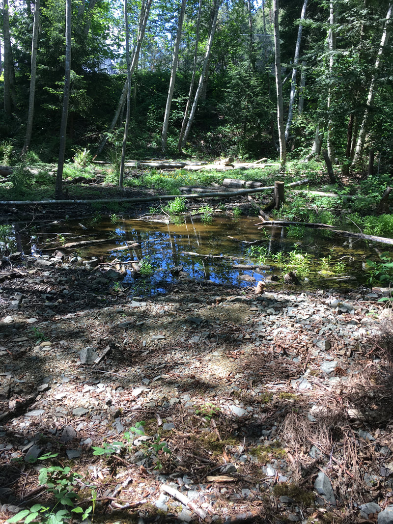
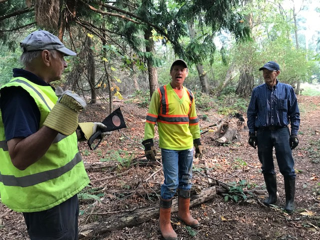
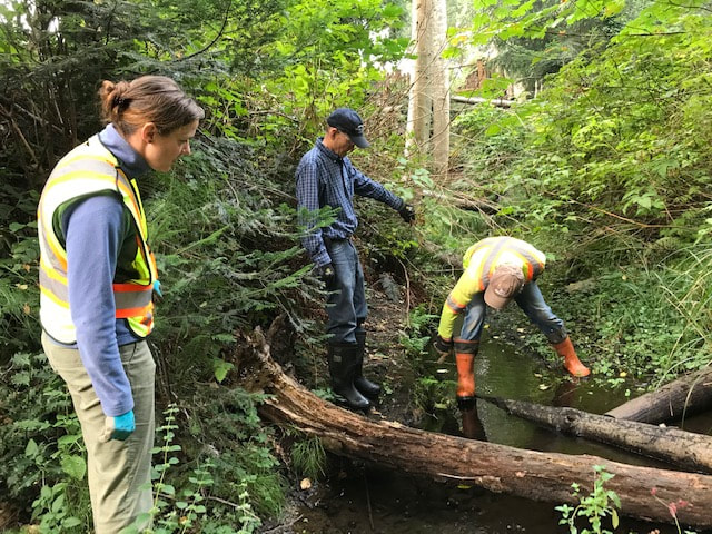
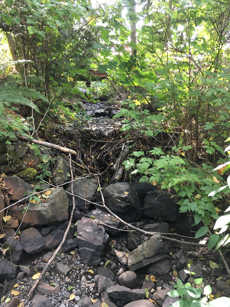
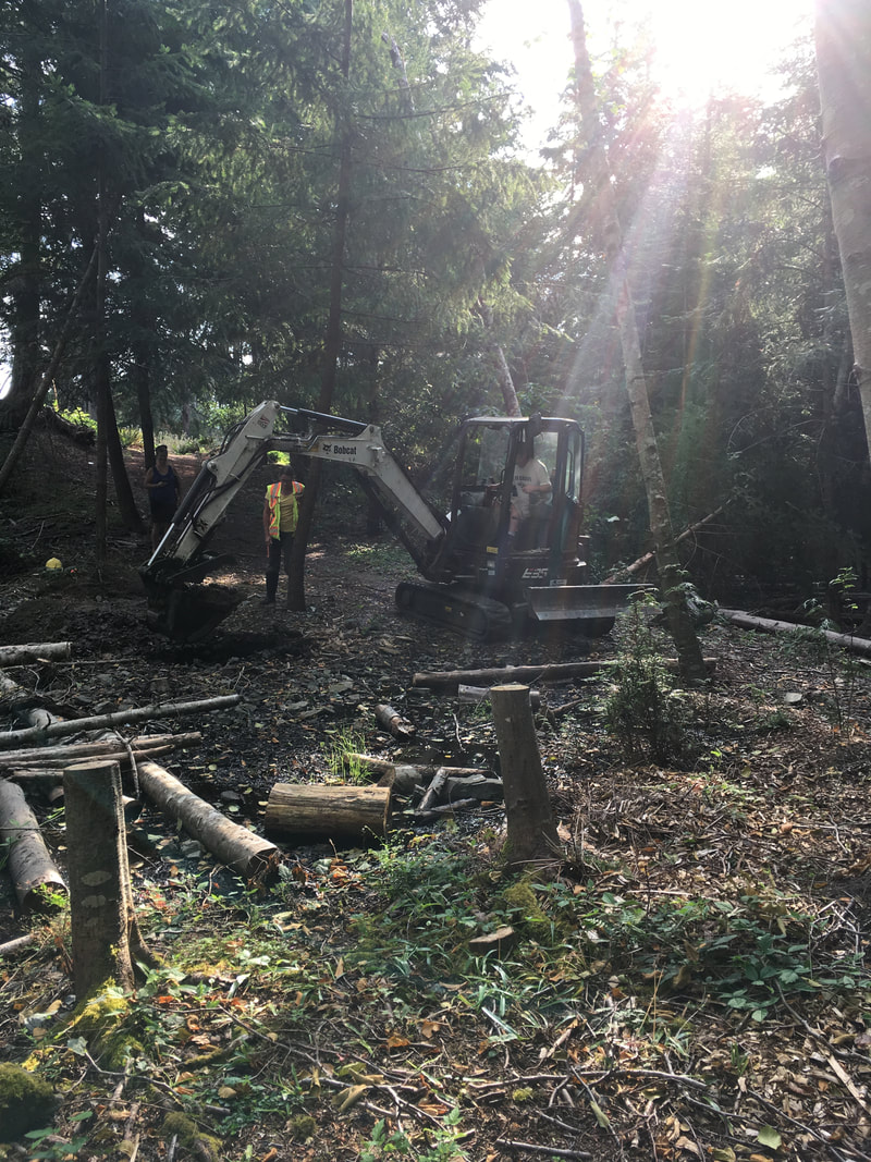
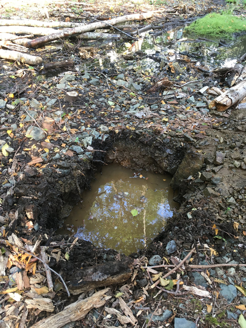
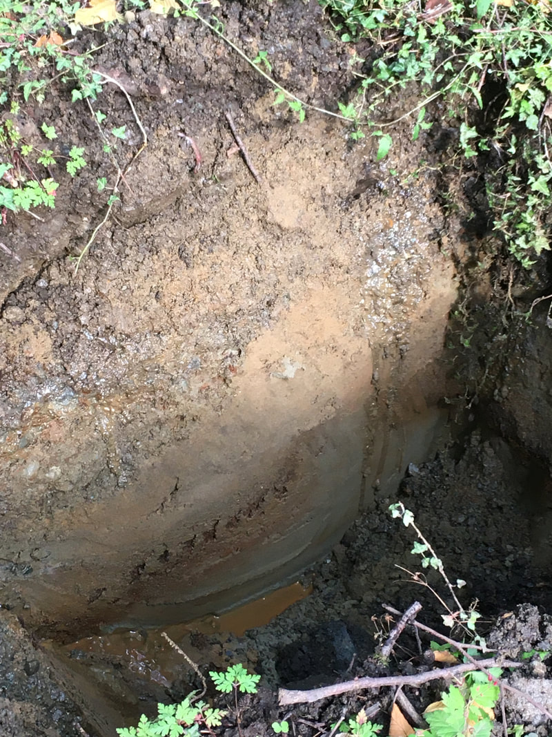
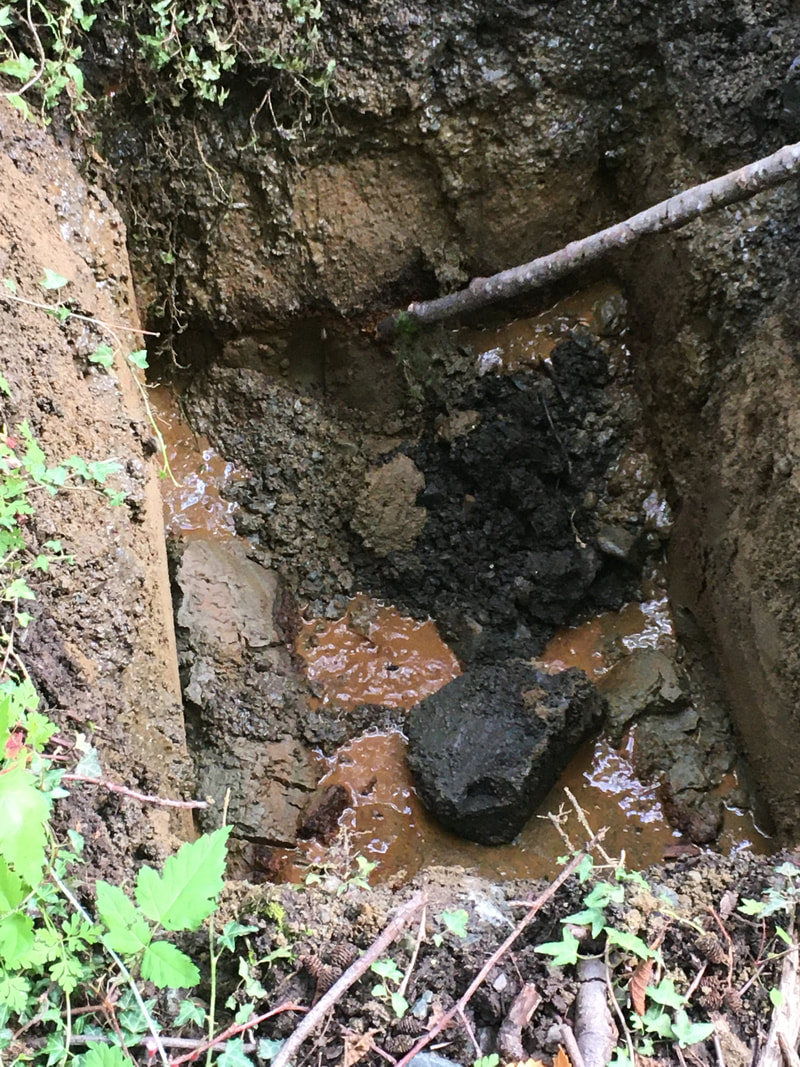
For the past year, we have worked with the City of Nanaimo to restore the riparian area in reach 2 (read more here). Between the crushed gravel path and the creek there is a shallow pool with some water flowing through it. With help from Elke Wind, herpetologist and wetland specialist, we investigated this area for potential wetland enhancement. The City of Nanaimo generously supplied an excavator and operator (Ryan) to dig test pits so we could examine the underground soil structure and better understand how water moves through this area.
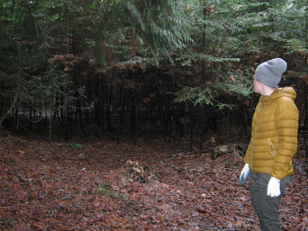
Ryan excavated 5 test pits so we could see if the water flowing through the wetland area is surface water or groundwater. We determined that it is surface water, possibly flowing from the north (ie. Shores Drive access to Neck Point). The pits filled up with water, so after filling the holes back up they were very soft (like quicksand). Ryan placed boulders and logs over top, and we flagged where the pits were. We did not expect the sandy substrate underneath the shale rock on the surface! As far as wetland enhancement - Elke suggested we could put in a pond liner with wetland plants around the periphery, or watch the existing surface water and plan to enhance what's there. Elke's advice either way is to watch the water level and flow before making further plans. 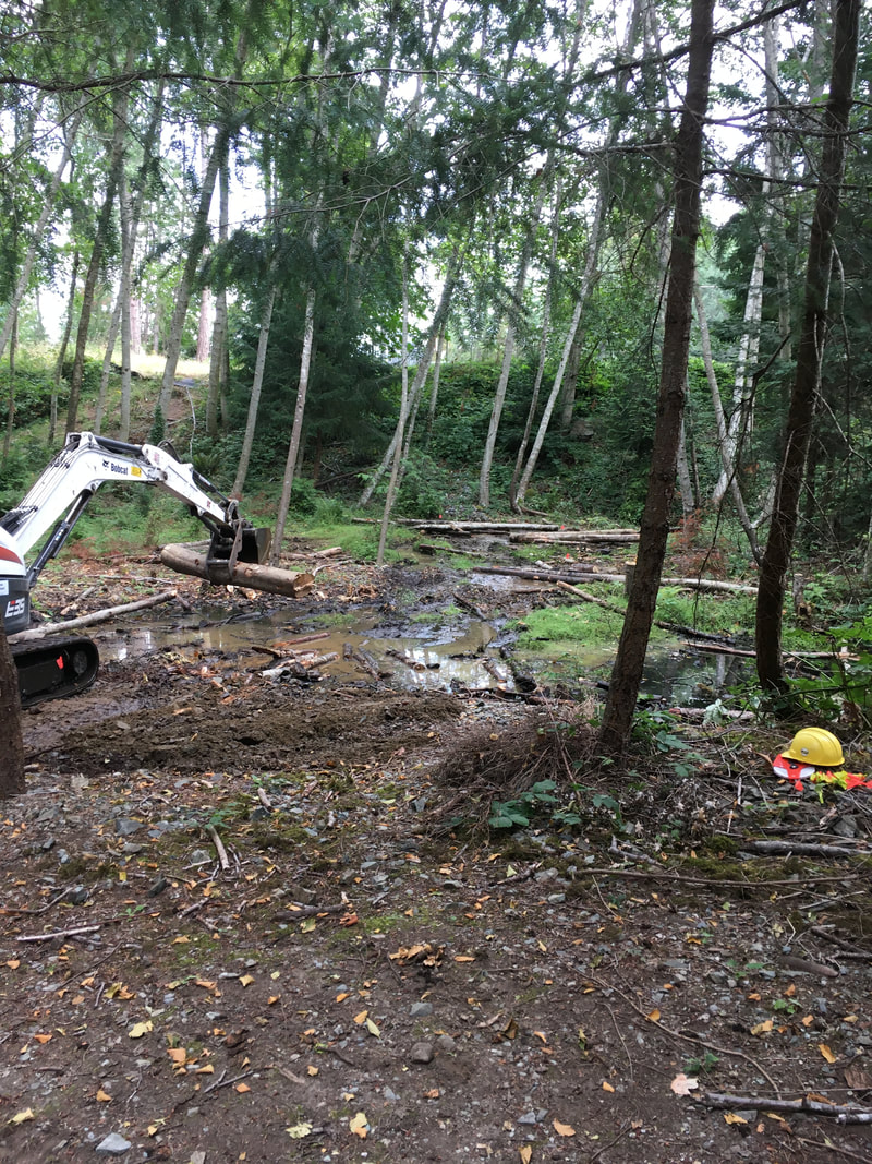 The wetland area after our investigations.
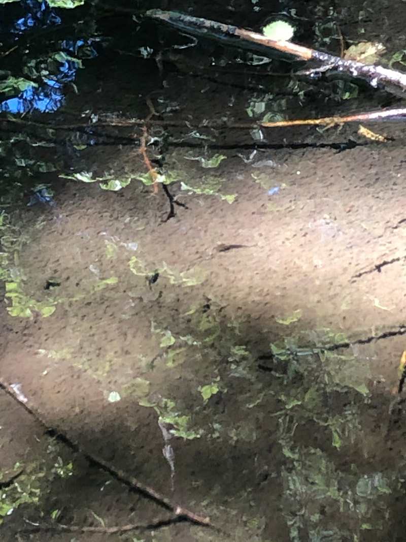
Nina Evans-Locke June 13, 2020, Saturday, 9 am. I was out early to do my weekly measuring of the creek depth in five different sites from Pipers Pub to the beach. Last year at this time, the creek was completely dry. So I have been measuring the depth of the creek, just to keep track of it. The second measurement site is just below Shores Drive. I walked down the riparian area to the edge of the pool and was about ready to lower my measuring rod when there was frantic thrashing of some small creature in the pool from one side of the small pool to the other, the creature went and all was quiet. Could it be a frog or toad? Salamander? What was it? I crouched down low to watch and then a small fish appeared in the middle of the pool, fanning the water over its gills, hovering just under the surface of the water. The pool was fed by a small trickle of creek water from upstream which then trickled out the other side, flowed under the gravel, and traveled subsurface. It was an isolated pool, fed by a meagre flow. I guessed that the pool was low on oxygen since it was small and isolated. All the excitement must have worn the fish out, so it hung just beneath the surface as if to say, "take a photo if you must." So I did. I leaned in close but the cutthroat trout didn't move. I identified it by its size, colour, and markings but especially by the red slash under its jaw. (I learned to do some identification while volunteering for the Departure Creek Smolt Trap count every spring - except this year, that is.) I reluctantly left the pool to complete my other measurements. 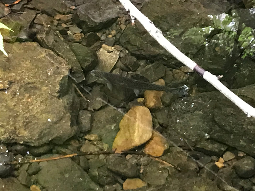 June 13, 2020, Saturday, 7:10 pm. Later that day, after some decent rain showers, I revisited the same pool. The rain had changed the flow in the creek. Much more creek water flowed through the site and the pool was no longer isolated. The water had been oxygenated. I couldn't see the cutthroat at first. So I disturbed the banks of the creek where it might be hiding and out it came with lots of energy. Back and forth across the pool and then quiet. I began to worry about the long term feasibility of the cutthroat to survive here and thought about the possibility of moving the fish upstream to larger pools there. The fish was helpless against river otters, birds, and other prey. June 14, 2020, Sunday, 10 am
I visited the pool once again and found the fish much more active with the continued lively flow from upstream. June 14, 2020, Sunday, 7:00 pm Later that day, I once again visited the creek and did not see any evidence of the cutthroat. I disturbed the edges and middle of the pool and nothing emerged. During the summer low flow season, trout can get trapped in pools and become stressed by high temperatures and lack of oxygen. We wondered what the best response is in this situation - leave the fish or move it to a deeper and more oxygenated pool? Dave Clough advised us that in some conditions it would be best to move the fish, but you can't legally do so without a fish salvage licence. He recommended we apply for one annually through Front Counter BC - Fish and Wildlife permits (research/scientific permits).
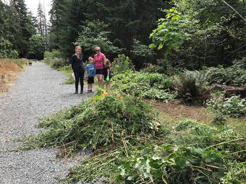
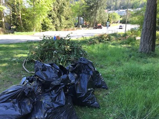
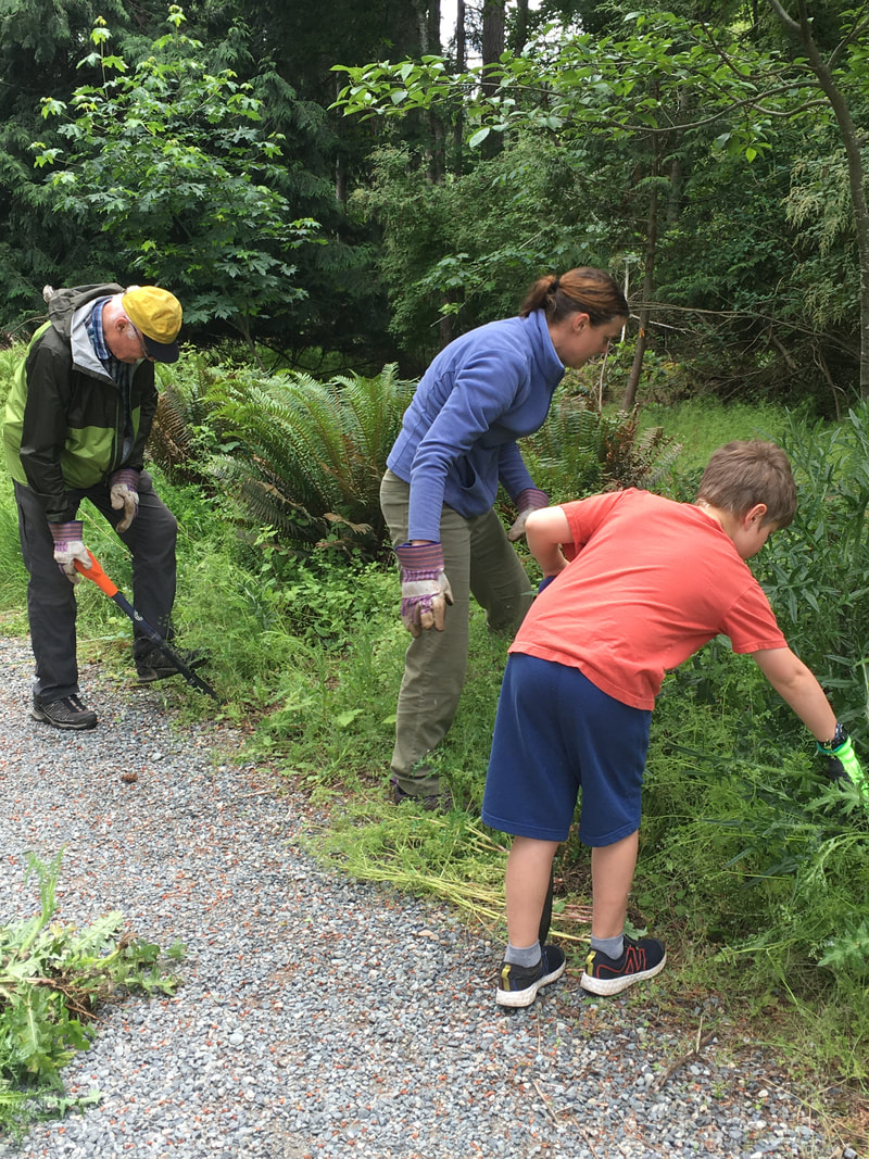 Our annual invasive removal in Morningside Park looked a little different this year. With schools closed and everyone practicing physical distancing, we relied on a small group of friends and family to tackle invasives in Morningside Park. Thistle, Daphne, and Ivy out-compete native plants like Oregon grape, ocean spray, and tiny fir and Cedar for sunlight and nutrients. By removing as many invasives as possible, we hope to encourage the diverse native plants to thrive. 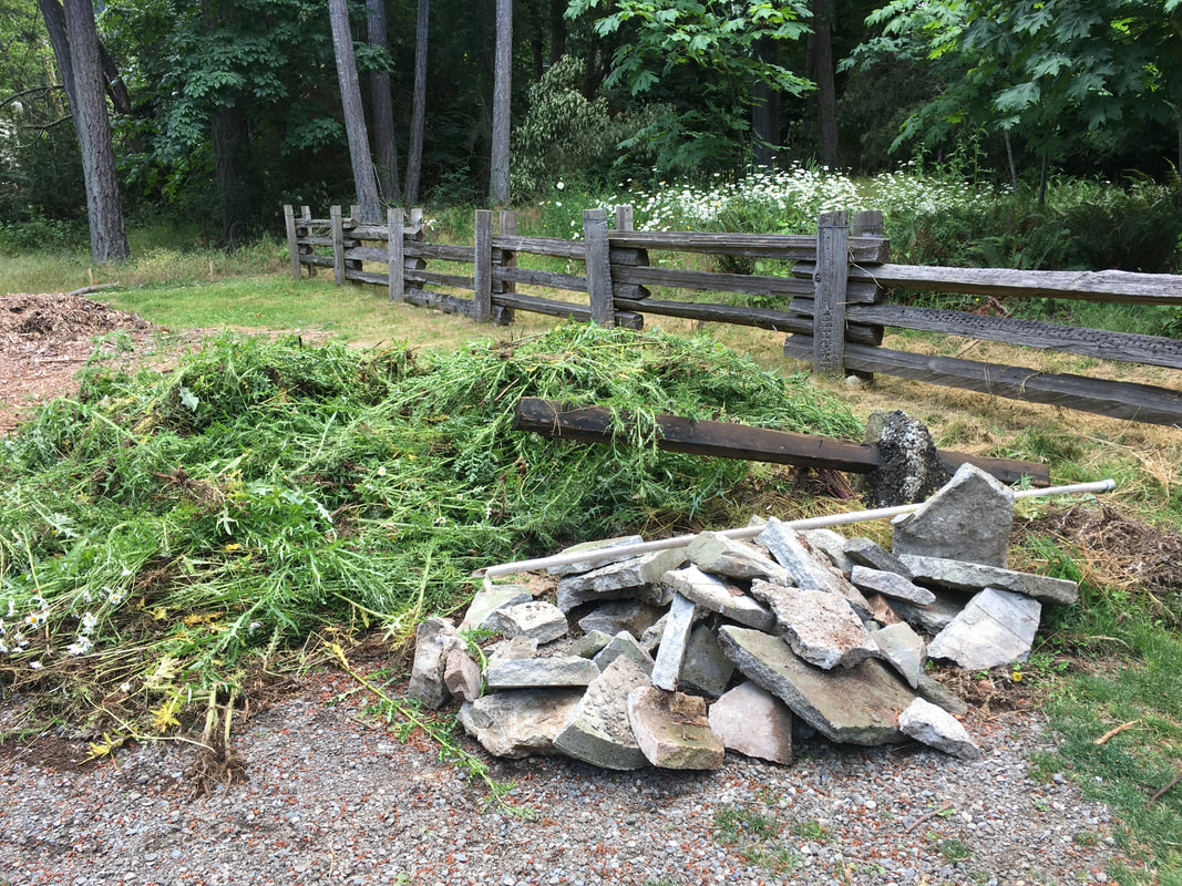 Illegal dumping of yard waste continues to be a problem in Morningside Park. Year after year we discover leaves, grass clipping, and even Christmas trees dumped over people's fences into the sensitive riparian area. Years ago someone broke up an old patio and threw the concrete chunks and fence post footings "away". "Out of sight, out of mind" behaviour degrades the slope stability, causes erosion, smothers native plants that are stabilizing the bank and providing shade, and can crush/impede wildlife. Through talking to residents who back onto the creek, we know that most neighbors understand the importance of properly disposing of yard waste. However, a part of restoration still includes removing materials that have been illegally dumped. We're hoping our continued work and outreach eradicates this problem!
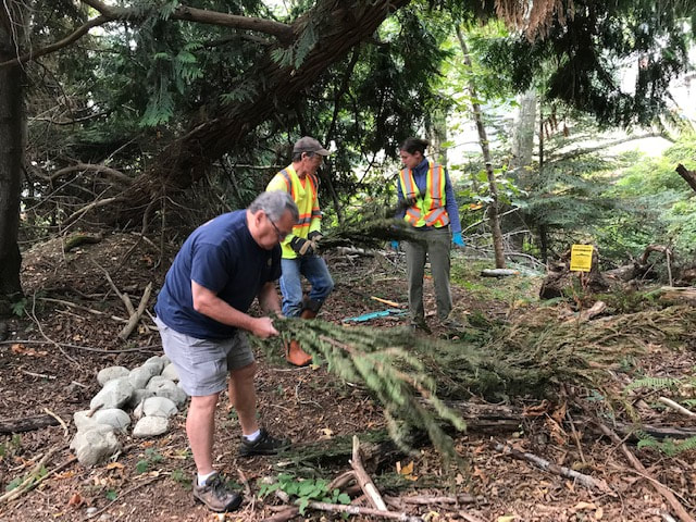
 Project area in Morningside Park BEFORE thinning, January 2018On October 25 Walley Creek Streamkeepers met with Rob Lawrance and Margaret Pimlott from the City of Nanaimo, along with Dave Clough, RPBio, to create a plan for improving the biodiversity in a part of the riparian area in Morningside Park. City arborists then helped thin an unhealthy stand of fir and alder that had self-seeded in an area full of rock fill. This created space for volunteers to plant a variety of native plants to increase the biodiversity of this area, and improve the water-retention qualities of a wetland area adjacent to the creek.  Project area in Morningside Park DURING thinning/before planting, facing the gravel path and Ecole Hammond Bay Elementary.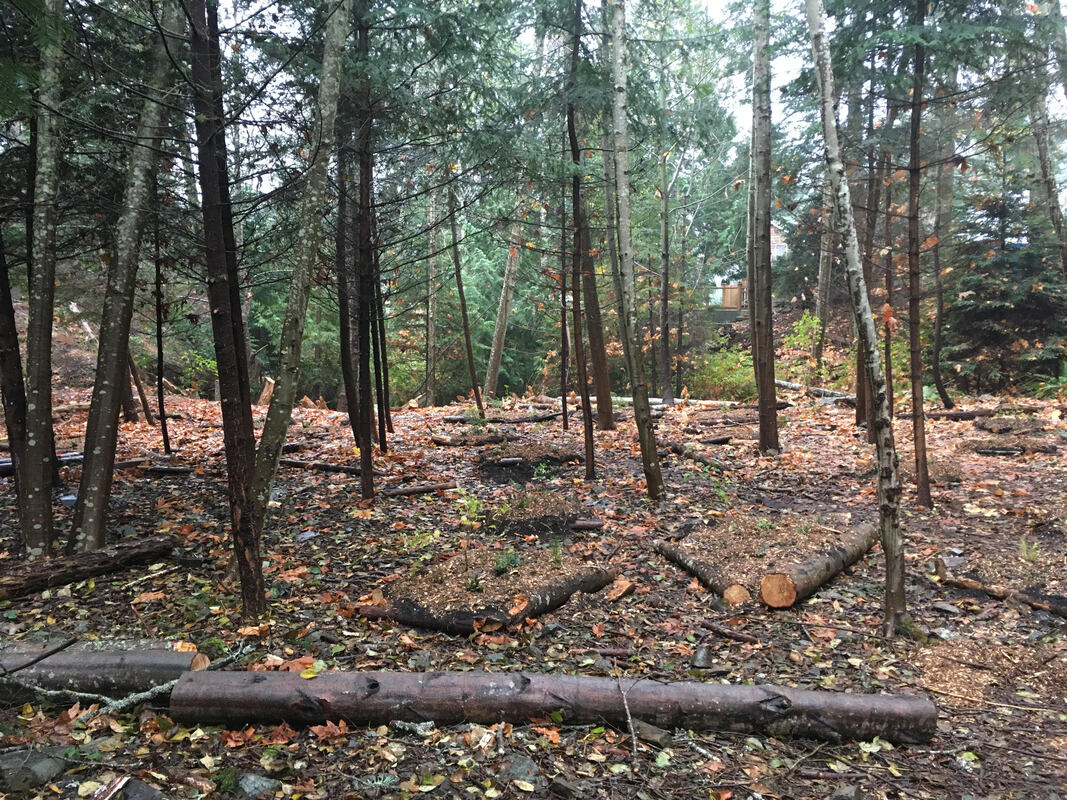 Project area AFTER planting, facing the creek and houses that back onto Walley Creek along Hammond Bay Road.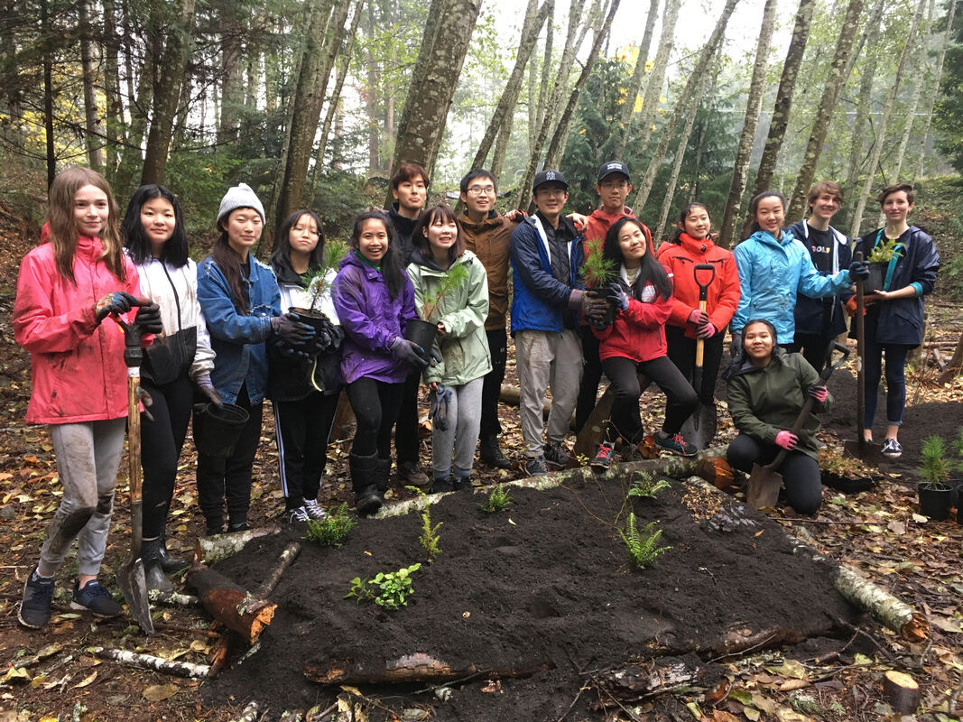 35 volunteers came out November 8, 2019 to help us improve the biodiversity in Morningside Park (Reach 2 of Walley Creek). They created polygons out of logs, moved 15 yards of topsoil and 7 yards of mulch, then planted 260 native plants and trees including snowberry, Indian Plum (Oemlaria), swordfern, Oregon grape, Douglas Fir, Western Red Cedar and pine. The day was a great success! High school volunteers from Dover Bay and Nanaimo & District Secondary schools brought energy and enthusiasm to the planting day. Rob Lawrance and Deb Beck from the City of Nanaimo volunteered their time, as well as many volunteers from the Nanaimo & Area Land Trust, Departure Creek Streamkeepers, and Snunuemuxw First Nation. We are so grateful to all the volunteers that came out and gave time, energy and expertise to this project! 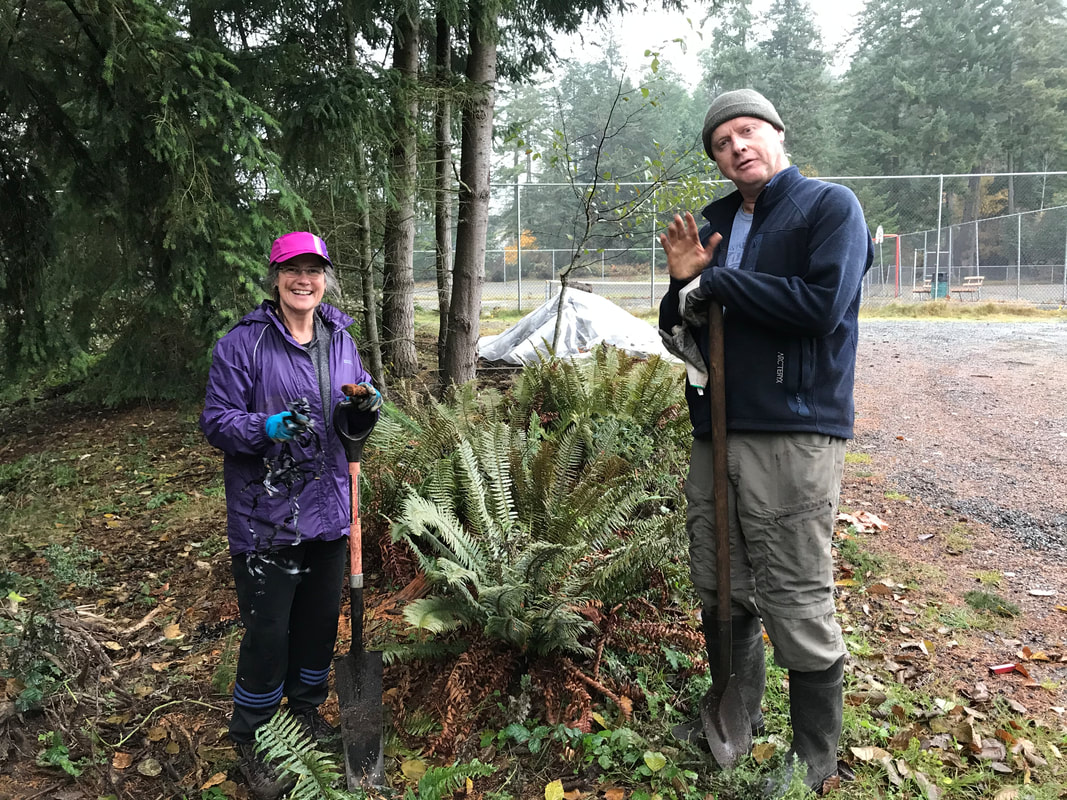 Each week since June we've been carefully watering the Oregon grape, ferns, Nootka rose, Snowberry, and Salmonberry that were planted in the riparian area back in March. We are careful not to let any treated "tap" water enter the creek, but volunteers soak the mulch and soil enough that the plants have a chance to get established this spring/summer. We have also spent many hours pulling invasive thistles along the gravel path. This area was disturbed in 2015 when the RDN upgraded the wastewater outfall at Morningside Drive. The City then replanted both sides of the path and installed an irrigation system to support Maple trees, Salal, Oregon grape and ferns until they were established. The irrigation system is no longer being used, and the native plants are being choked out by opportunistic weeds. While we focus on the riparian area and salmon habitat, we recognize the importance of this park land as a corridor and habitat for many other animals. This is one of many tasks we take on in this "adopted" park.
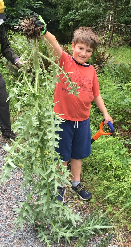
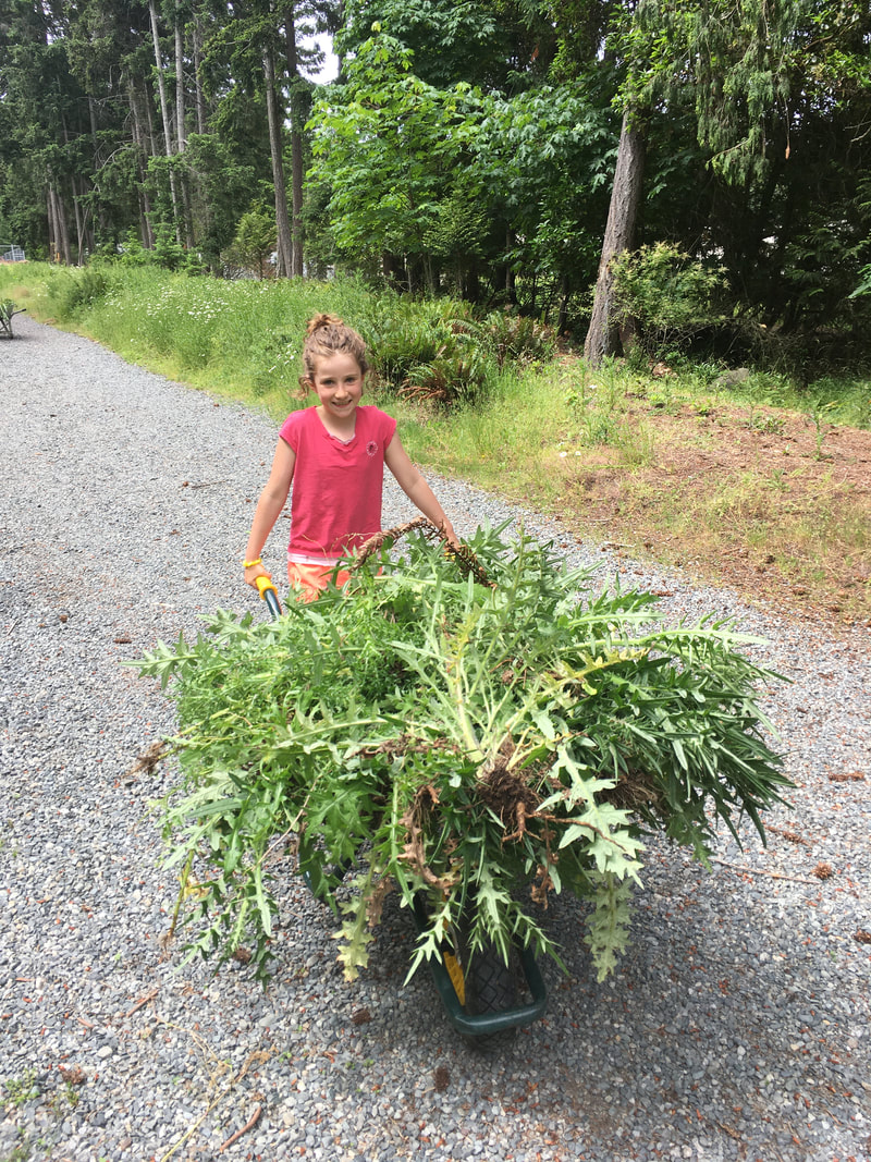
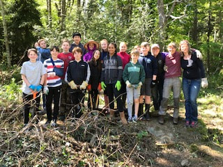
This was the third year grade 7 students from École Hammond Bay participated in a work party to give something back to this community park that has been a place to explore and appreciate nature during their time in elementary school. Parents conceived this project as a way for students to be meaningfully involved in fundraising for Grade 7 year-end activities. Each year students gather pledges for a couple of hours of work with the Walley Creek Streamkeepers, DFO and City of Nanaimo staff. Extra funds are donated back to the Streamkeepers, who use the funds to help with our outreach and education activities. Every year the young people have a chance to learn about the importance of native plants and trees to stabilize the stream banks and provide shade and habitat for fish, amphibians, invertebrates, and mammals that live along Walley Creek. Then they participate in removing invasive species like Daphne, Himalayan blackberry, and ivy so that native plants and trees can flourish. Their hard work and enthusiasm help us accomplish so much in this beautiful little City Park!
|
Categories
All
Archives
March 2024
|
||||||||||||||||||||||||||

 RSS Feed
