WALLEY CREEK STREAMKEEPERS
  • What We Do
  • Location
  • Projects
  • Blog
  • Resources
  • What We Do
  • Location
  • Projects
  • Blog
  • Resources
Picture

walley Creek

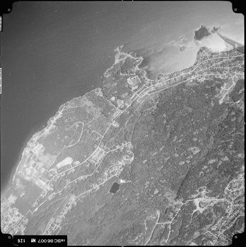
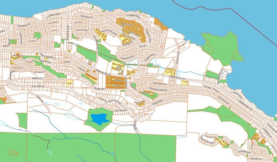
The Walley Creek watershed encompases 120 ha in the City of Nanaimo.

The creek originates in a forested marsh west of Entwhistle Drive and flows approximately 2.5 km into Hammond Bay near Neck Point Park.

A trail system along Walley Creek is highly valued by the local community,
​and there are several important wetlands and green spaces designated as City parks. 

DESCRIPTION

For the purposes of describing the creek and establishing restoration priorities, consultant biologists have divided Walley Creek into the following "reaches" with similar gradient, width and riparian cover: 
  • Reach 1 Hammond Bay beach to Morningside Drive
  • Reach 2 Morningside Drive to Shores Drive (including Morningside Park)
  • Reach 3 Shores Drive to McGuffie Road (including RDN GNPCC)
  • Reach 4 McGuffie Road to Vista View Crescent (including strata neighborhood and Piper's Pub)
  • Reach 5 Vista View Crescent to Williamson Road (including paved path to Harry Wipper Park)
  • Reach 6 Williamson Road to Fillinger Crescent (including Frank J Ney Elementary)

HISTORY

Why Walley?

Early European and Asian immigrants to Nanaimo settled in the area fronting Newcastle Channel, with easy access to the harbour where coal and timber were exported.  At that time Hammond Bay Road was nothing more than a trail, and later a dirt road.  Rain water and ground water were conveyed through this watershed by a valley bordered by two rocky ridges - what is now Rocky Point to the north and Linley Valley to the south.  To our knowledge the Walley Creek watershed has been occupied by both Snuneymuxw and Snaw-naw-as people.  For some indigenous history of the area (through a settler lens) see our Resources page.

Where did the name Walley Creek come from?  Persistent sleuthing put us in touch with the grandson of Robin Walley, who owned property along McGuffie Road, and secured water rights to the creek in the 1950's. 

Robin Walley senior was born in Nantwich, England in 1885. He was educated in England and was listed in two documents as a chemical engineer, or just "chemist."  He came to Canada sometime early in the 1900s and lived in Nanaimo, where he met and married Clovis Walley (nee Browning) in 1916.  Mrs. Walley told stories of early Nanaimo including seeing the members of different First Nations coming into Nanaimo to fish and pick berries when she was a child. 

Mr. Walley bought all of the property along McGuffie Road from the ocean to Hammond Bay Road in 1948.  His plans for the creek were to build a salmon hatchery at McGuffie Road and also plant a holly farm further up-Island.  English Holly is an invasive species here, so it's a good thing he didn't proceed with this plan. There are no signs of a salmon hatchery, so perhaps this plan also came to nothing.

Development


Another long time resident, who lives on Hammond Bay Road, described how her family's original piece of property ran from Hammond Bay Road all the way down to the ocean (now Fillinger Crescent).  Over time the properties in this area have been divided and sold as Nanaimo's population expands.  Development exploded in the 1980's as then-mayor Frank Ney saw the potential to develop the north end into commercial and residential properties. 
Picture
                           aerial photo, 1986

Greater Nanaimo Pollution Control Center (GNPCC)

Thirkill, Charles. 2002. Nanaimo: City of Living Streams. Coho books: Nanaimo.
​

"The creek flows east towards McGuffie Road, then past the Regional District of Nanaimo Water Pollution Control Centre (the sewage treatment plant).  A pond was built here in 1974, to incorporate the creek into the building design. In 1998 the pond was an aesthetic addition to the plant, and added an environmental touch to the site. A four-foot weir retained water that was over a metre deep. It supported thousands of stickleback, a few ducks, a heron, and a kingfisher or two. The water was probably too warm in summer to support trout or salmon fry. The weir was a barrier to fish passage and the pond was cut off from the lower reaches of the stream. At the time of writing, the weir has been removed, and a stream flows past the sewage treatment plant. Deer are often seen in the area, grazing on the new vegetation. This section of the stream will probably be redirected when the treatment plant is expanded."
(Thirkill 2002: 21-22)

The RDN website lists the history of its waste water treatment facility in Nanaimo.   Upgrades to secondary treatment were completed in 2020.​

Powered by Create your own unique website with customizable templates.