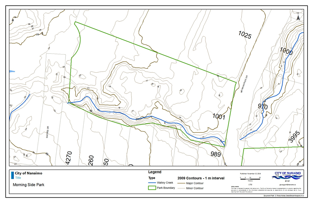
|
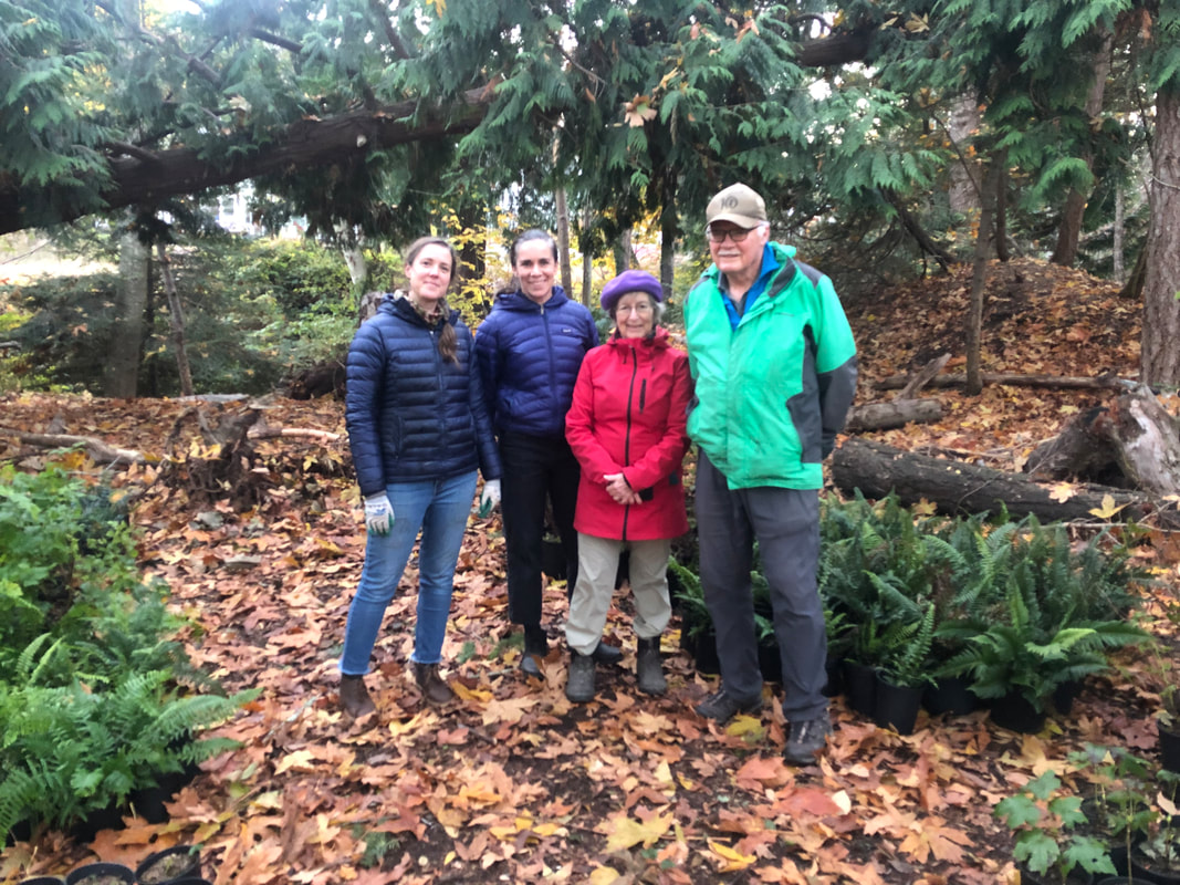
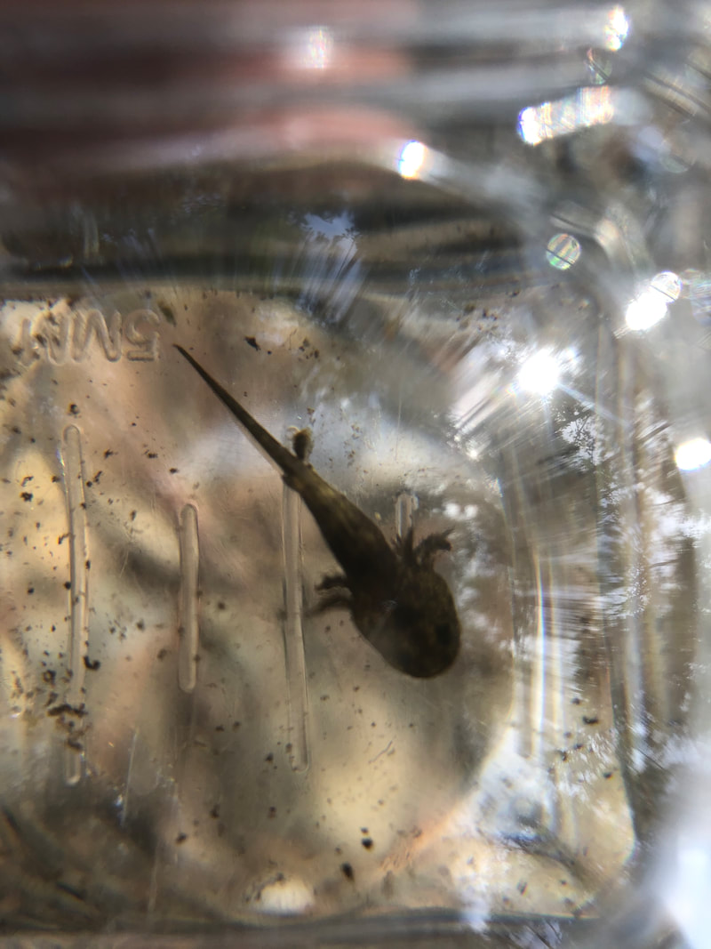
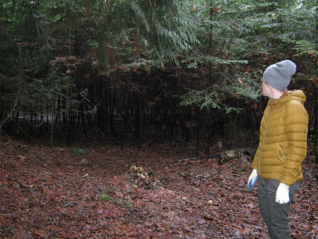
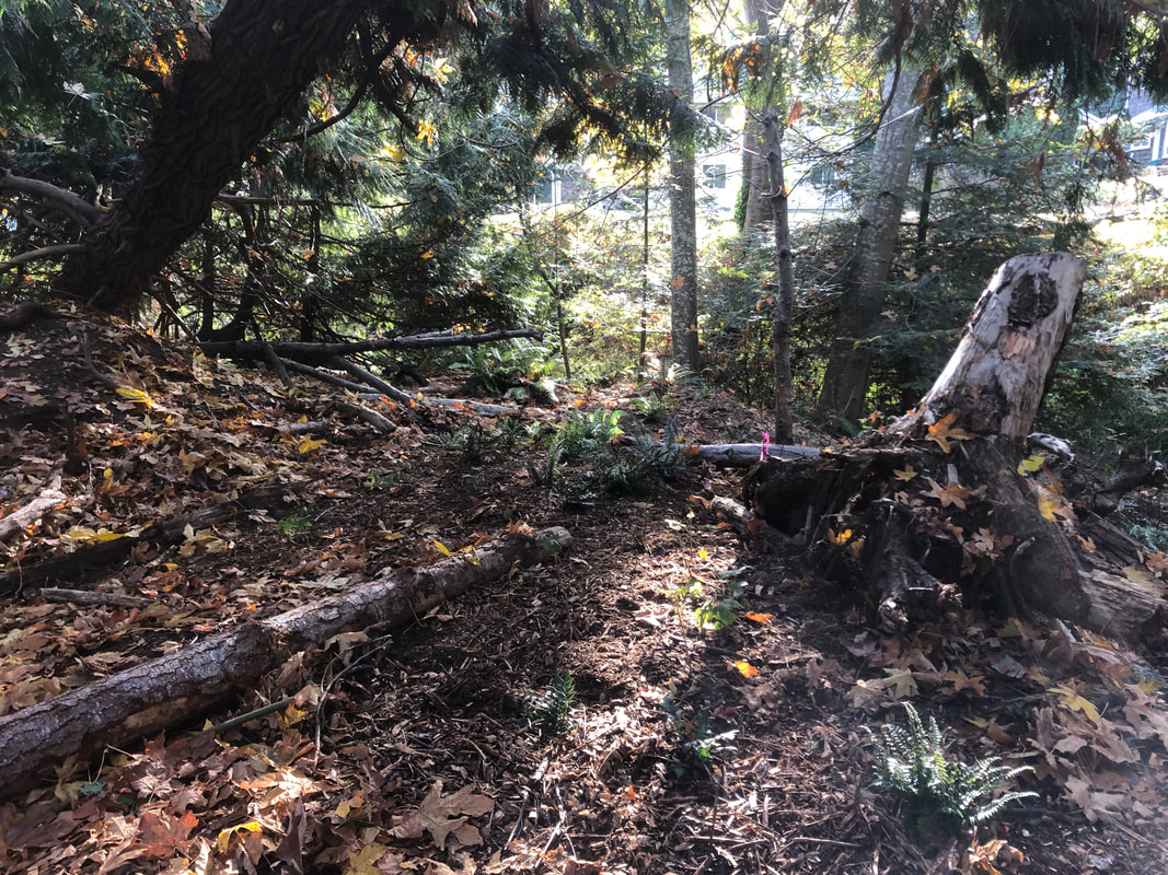
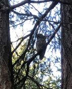
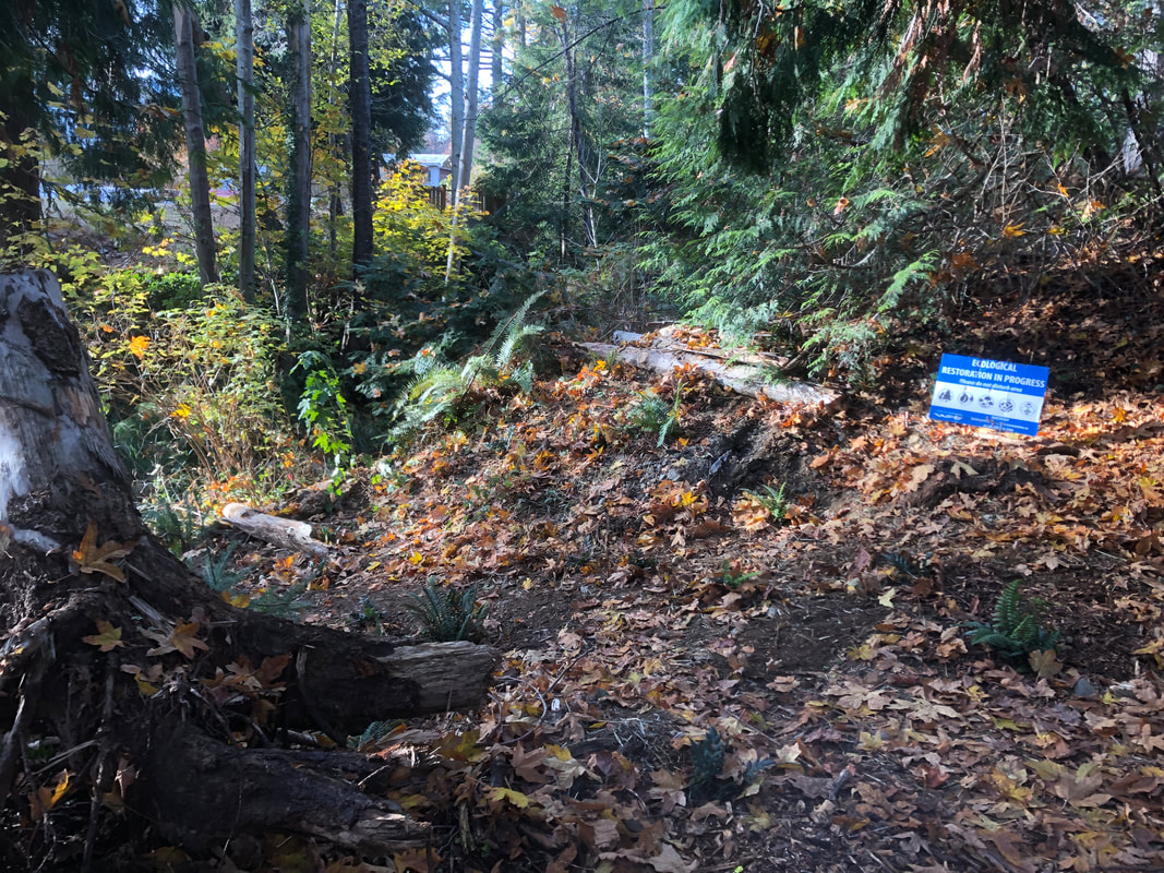
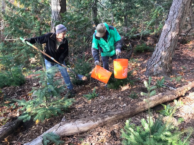
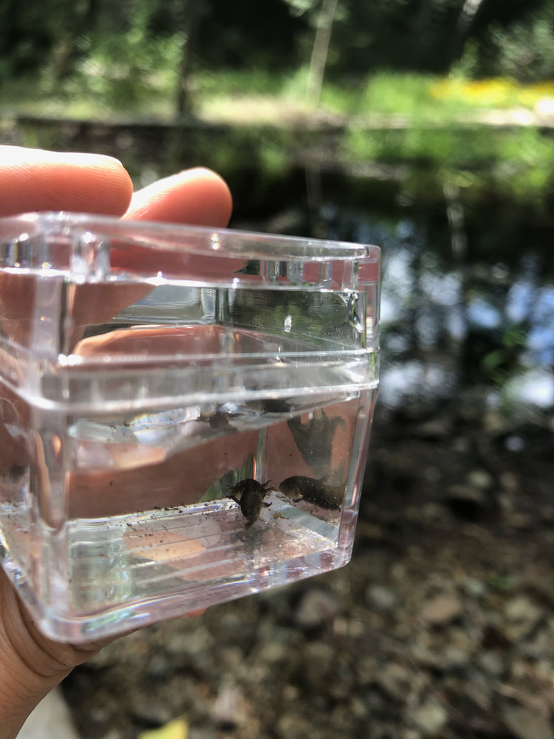
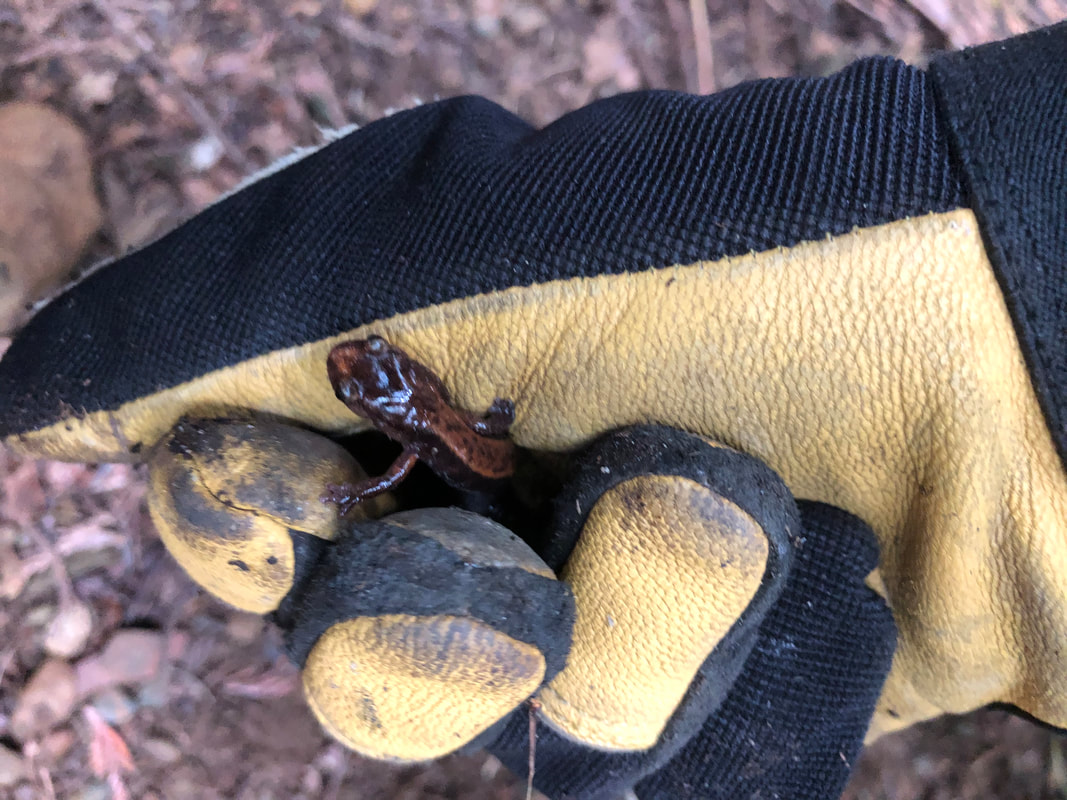
On this gorgeous fall day we set out once again to prevent the bank from eroding where Walley Creek flows behind private residences between Hammond Bay Road and Ecole Hammond Bay. We wonder if this problem was caused by the creek being moved? There is a natural seep that flows from a different direction, past the tennis courts and through the salamander meadow. The erosion is exacerbated by yard waste being thrown over the fence, though all but one neighbor has cleaned up their act. In any case, our goal is healthy fish habitat, and keeping the creek from filling up with silt and soil if there are debris jams and high flows. This design was suggested by Lindsey Haist of Alder Environmental, and it's been very successful so far. Today we reinforced "benches" built in previous years, installed new ones, and planted sword fern and dull Oregon grape, hoping their roots will take hold. We had a strong crew of family (Nina's husband, children and grandchildren, and Linda's husband and children), dedicated volunteers, and recent VIU grads to pull this off in a couple of hours. We were so grateful for a delivery of healthy plants from Streamside to restore the biodiversity of this area. The project was completed with support from the City of Nanaimo Community Watershed Restoration grant, project management and volunteer coordination in partnership with the Nanaimo & Area Land Trust, of which Walley Creek Streamkeepers is a committee. There happened to be an interpretive tour of the salamander monitoring project in this area led by Elke Wind at the same time that we were working! The group found three dead naked mole rats, that could have been victims of rat poison?? We also encountered some very angry wasps, who are cranky during this fall season and took it out on a couple of volunteers, ouch! 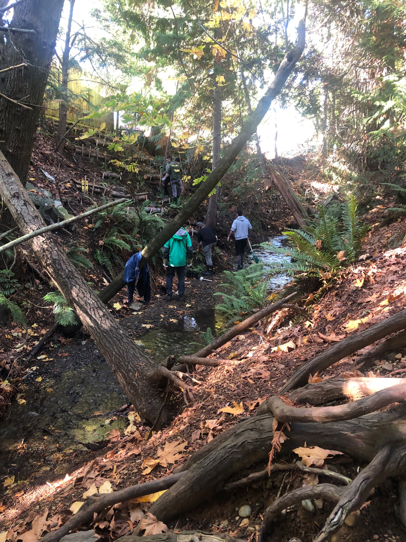 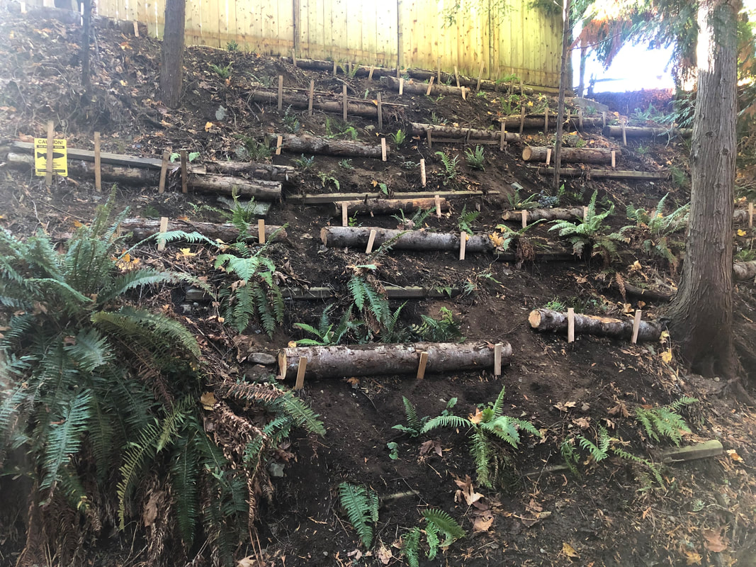 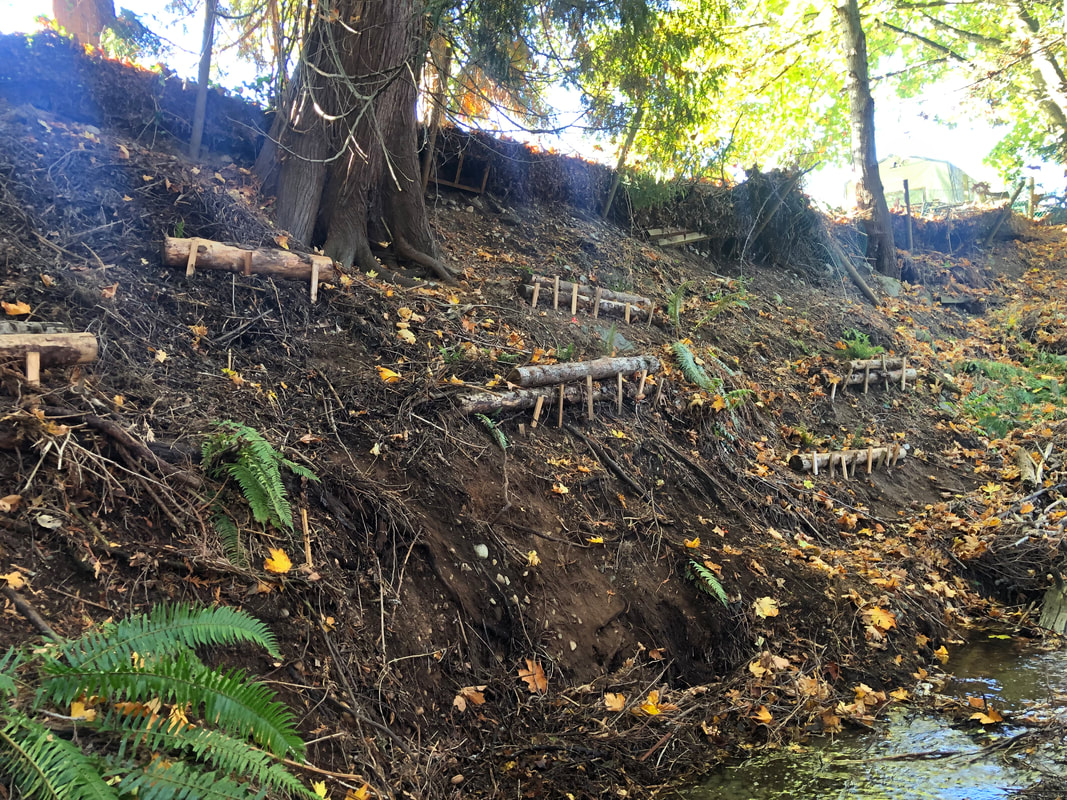
0 Comments
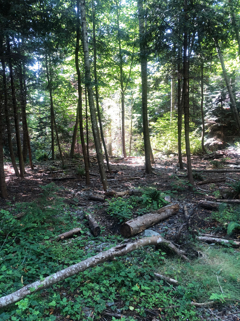
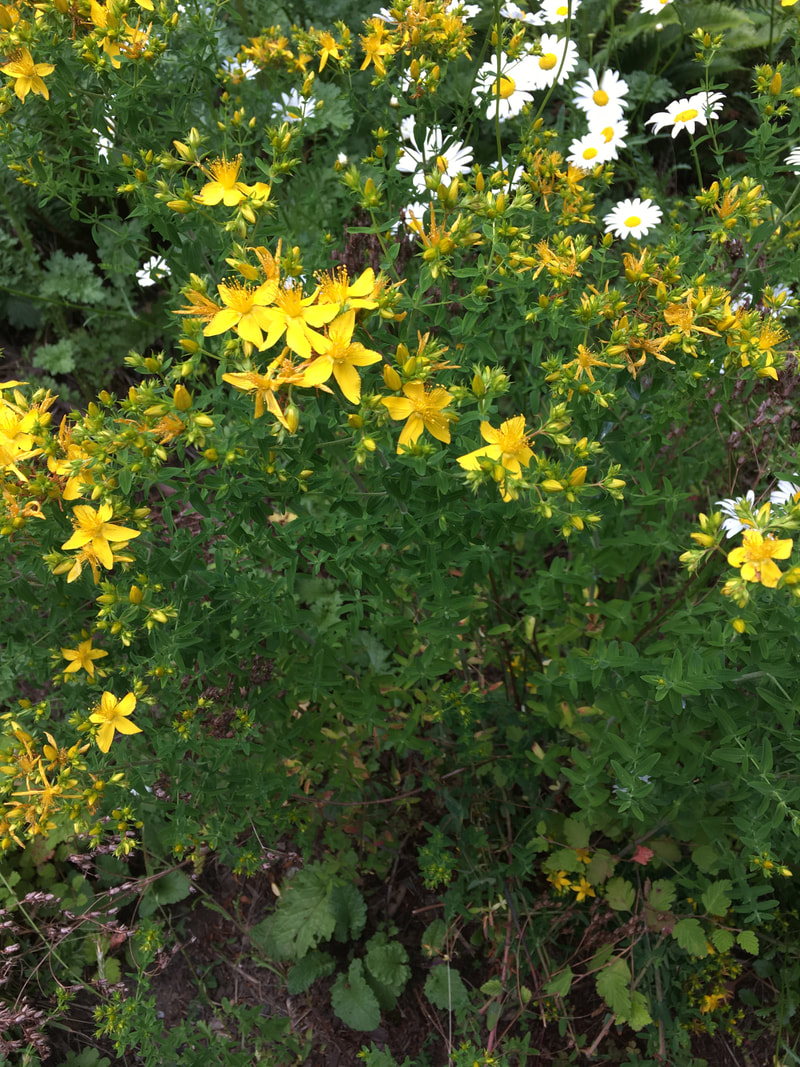
Our group has a nice rhythm of spring/summer invasive removal and fall planting. This has the goal of increasing biodiversity, stabilizing the stream banks to prevent erosion, and restoring the plant communities that were here pre-disturbance.
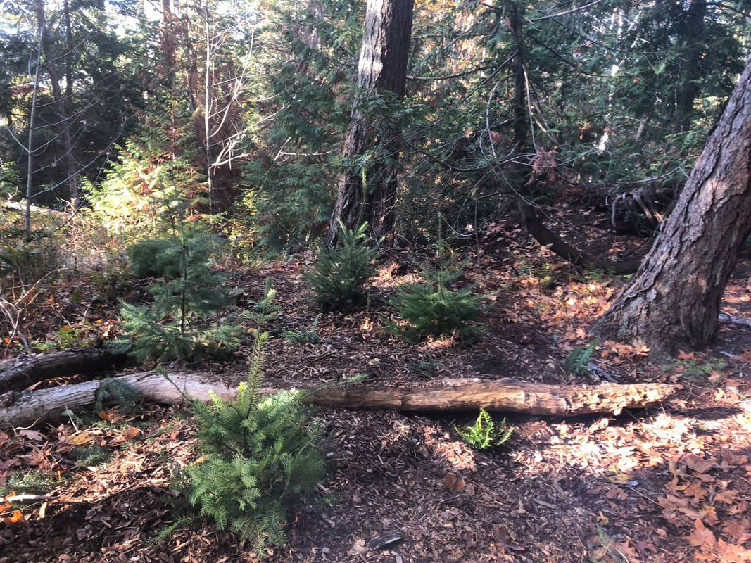
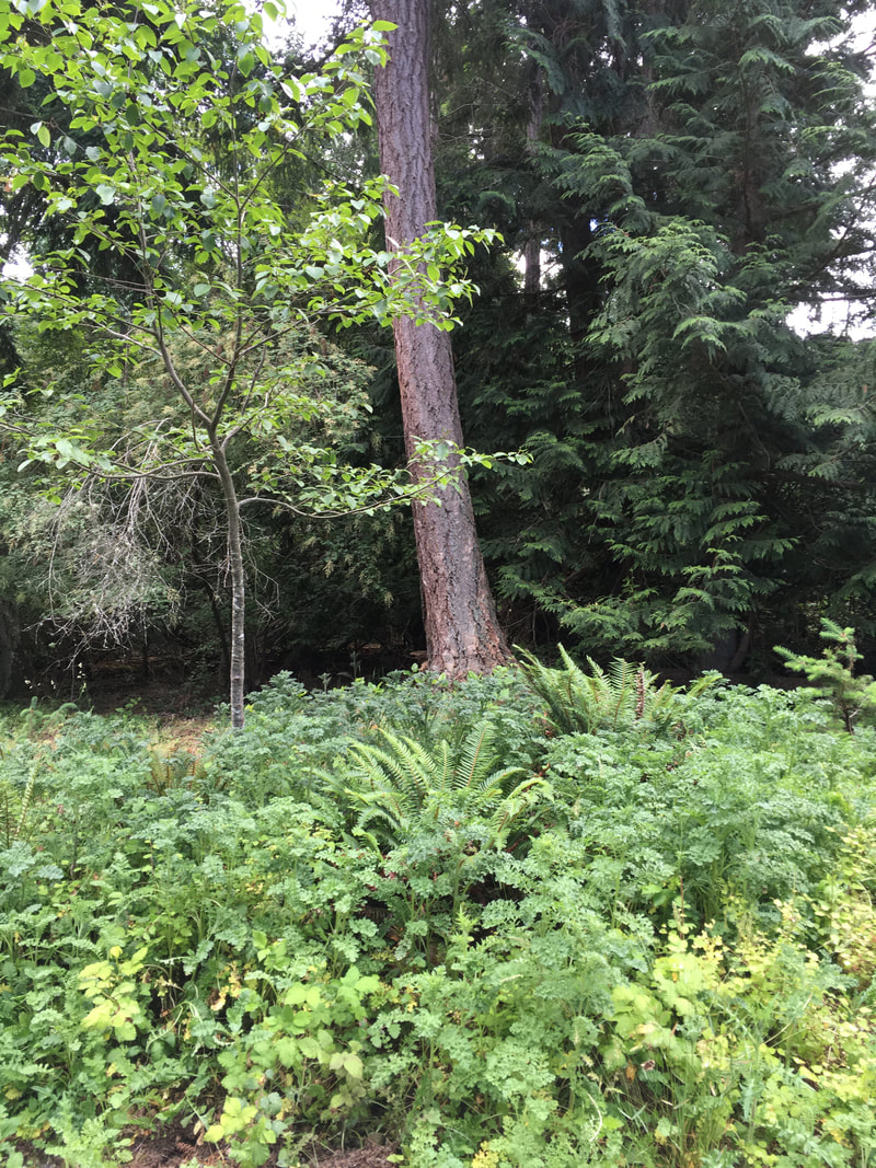
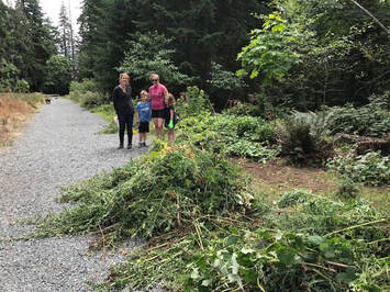
We are learning that it's not as simple as putting plants in the ground. Despite best efforts at placement, some plants get trampled, browsed by deer, suffer from summer drought, or don't make it for unknown reasons. We've learned that ferns and Oregon grape are nearly indestructible, though they haven't survived well on the steep slope stabilization projects. The key seems to be considering which plants need "wet feet" - salmon berry and Cedar, for example, and which ones can tolerate drier conditions - snow berry and pine. Then adding lots and lots of bark mulch and wood chips to hold onto moisture and nutrients in our dry summers. Even still, not all the plants survive. We keep planting densely, using chicken wire and Plantskydd to deter the deer, and repeating planting as we assess what's surviving. It makes us grateful for the established trees that are there, and appreciate the truth in the saying, "The best time to plant a tree is 20 years ago. The second best time is now." In November 2022 we planted over 250 plants from Streamside Native Plants over several days with the help of over 20 volunteers recruited through NALT, as well as a group of students from Ecole Hammond Bay. In February 2023 a small group got the last few plants in the ground!
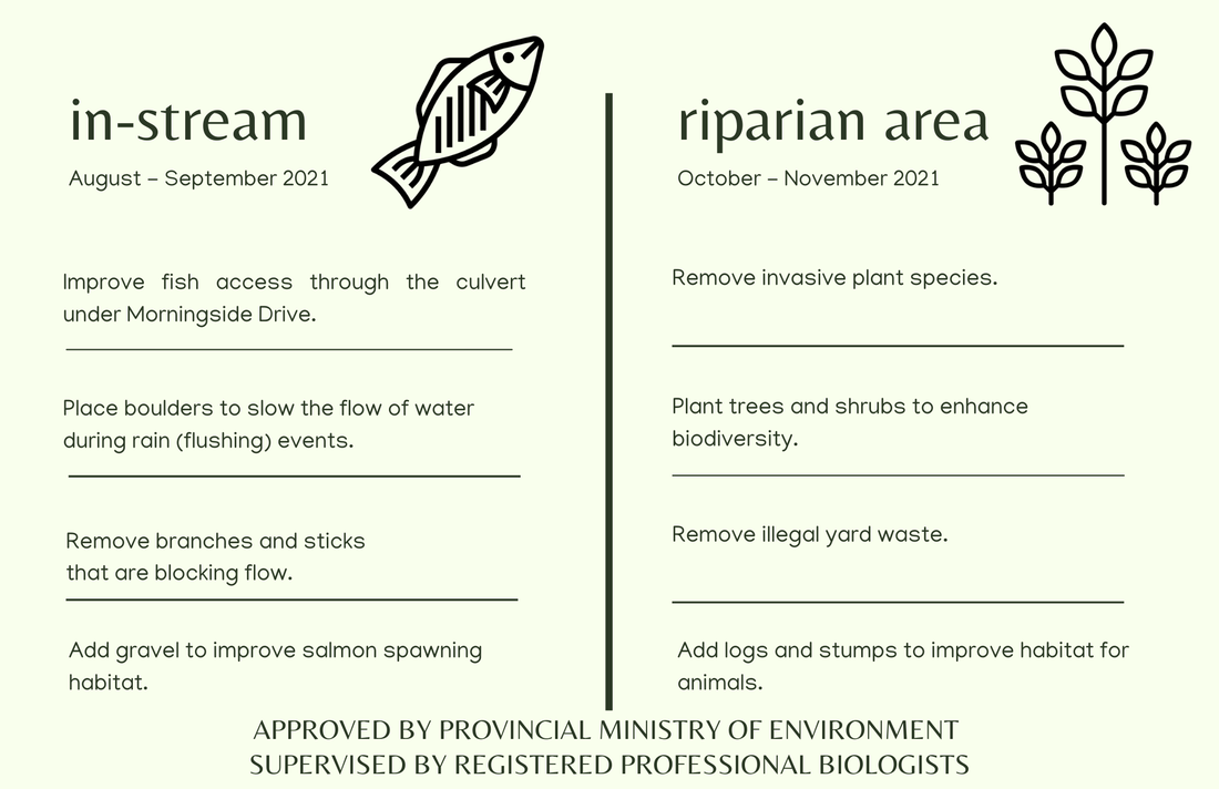
 The Walley Creek Streamkeepers, in partnership with the City of Nanaimo, Snuneymuxw First Nation, and Department of Fisheries and Oceans (DFO), are undertaking a restoration project this summer to make the creek healthier for the fish and other animals that live there. Walley Creek has resident cutthroat trout, and has the possibility to support Coho salmon. In-stream work can only happen during the window of August 15 to September 15. This is to prevent damage to sensitive fish habitat. In-stream work requires a permit from the Provincial Government, and is done with the greatest amount of care possible, with the goal to leave the fish habitat better. Outside of this time, nothing should ever enter or block the water – not humans, animals, or tree parts. If branches and other “small woody debris” incidentally enter the water (through storms or getting flushed downstream) volunteers must remove blockages, with permission from DFO, the City and the Province. This work is supervised by Dave Clough, R.P.Bio. 2021 planned in-stream work (summer):
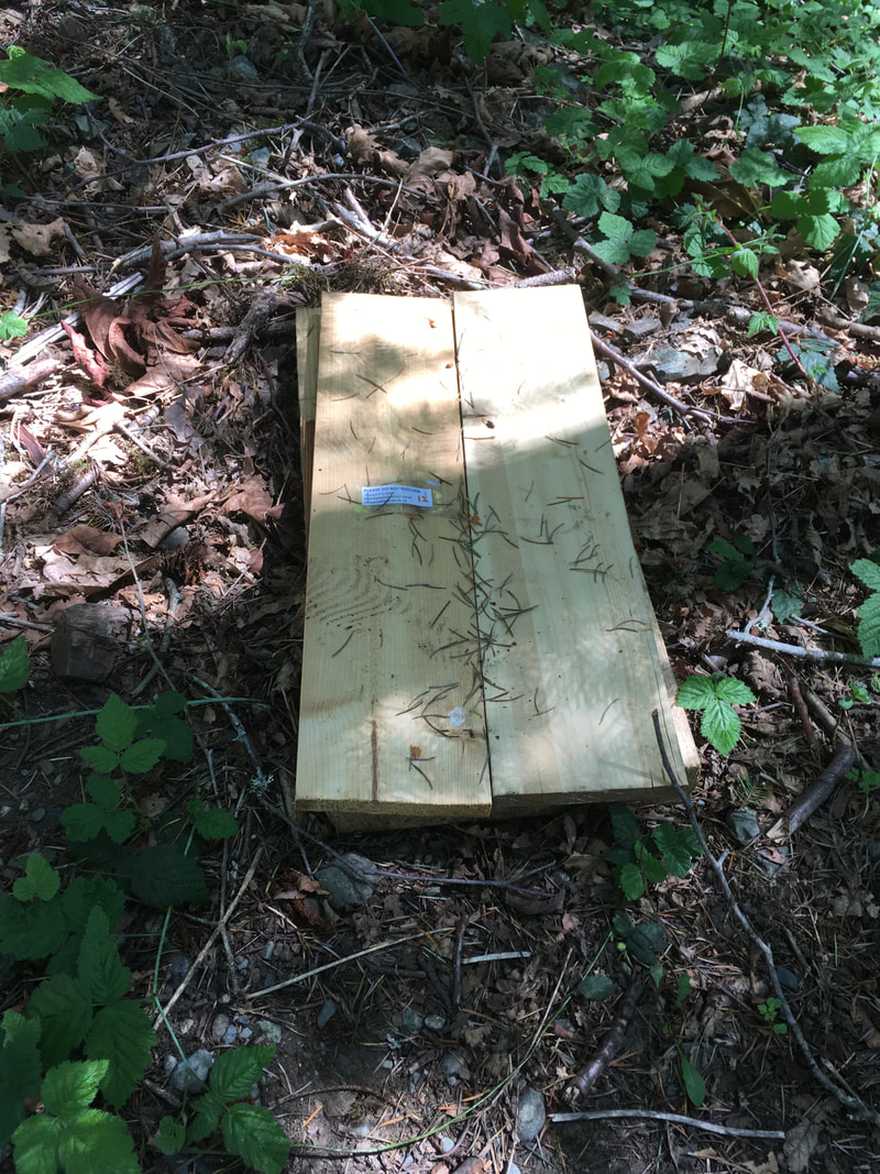
 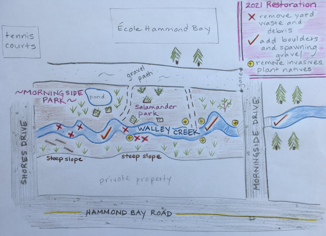  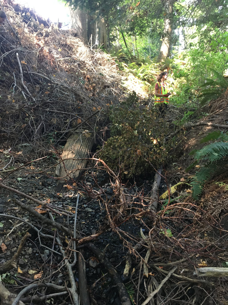 Yard waste and small woody debris block stream flow. 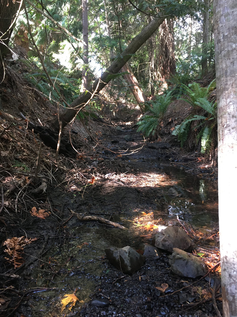 After removing small woody debris (upstream view). 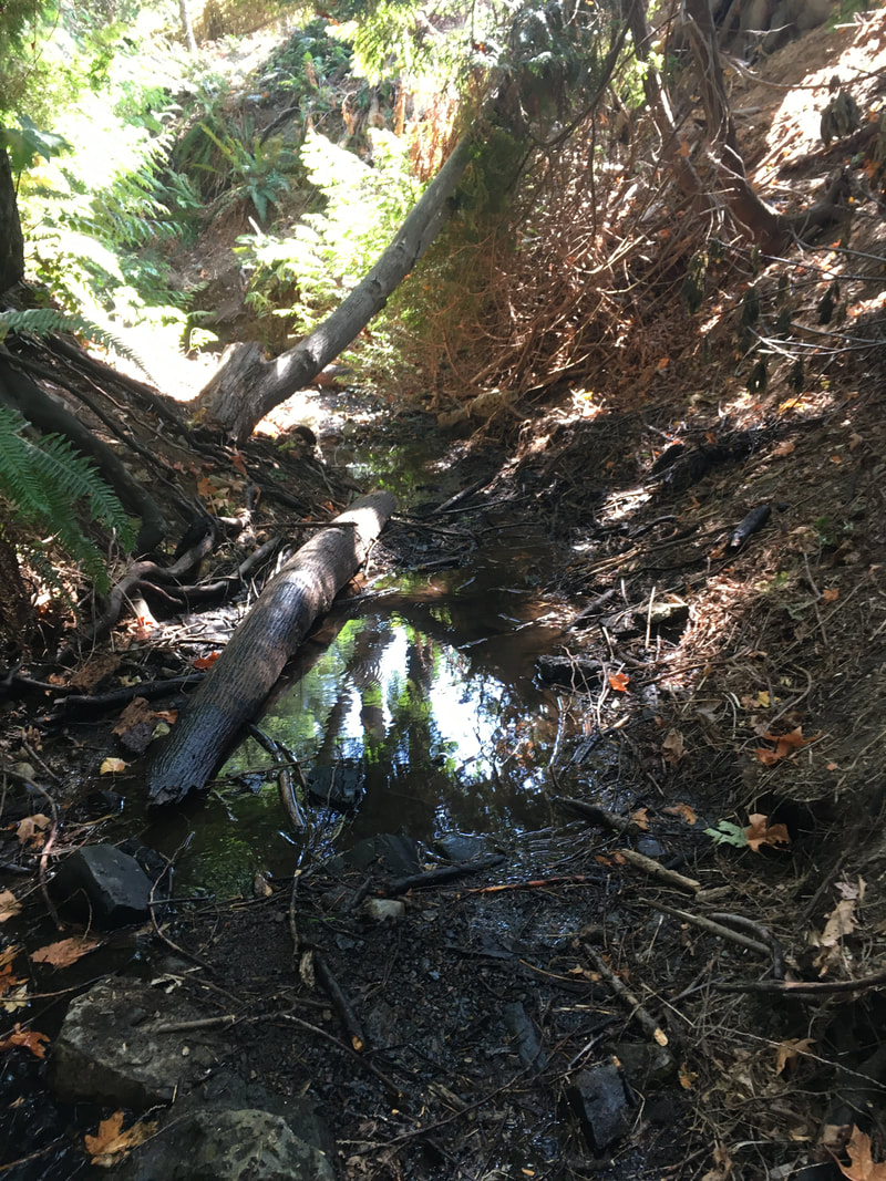 After removing small woody debris (downstream view). 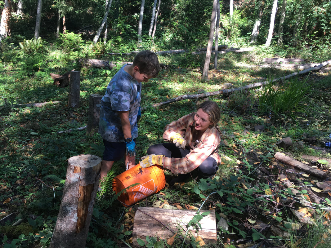 Relocating a salamander found while removing fine woody debris from the creek. 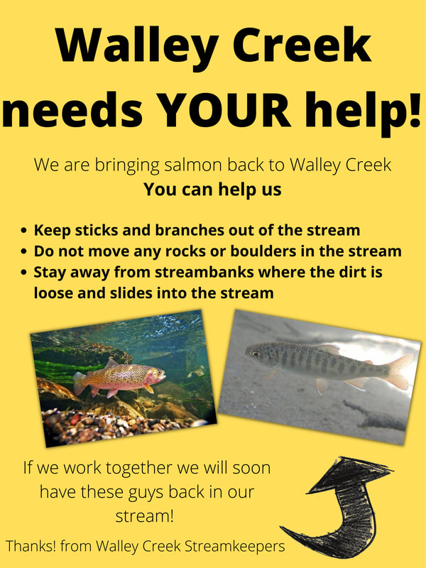 A team of hard working volunteers worked to improve fish access to the culvert under Morningside Drive. This work had been done in (year?) but time and heavy rains had washed it out. Volunteers under the direction of Dave Clough carried boulders down to the stream and placed them in a gradual slop up to the culvert. The project stood up to torrential rains that came in early October. 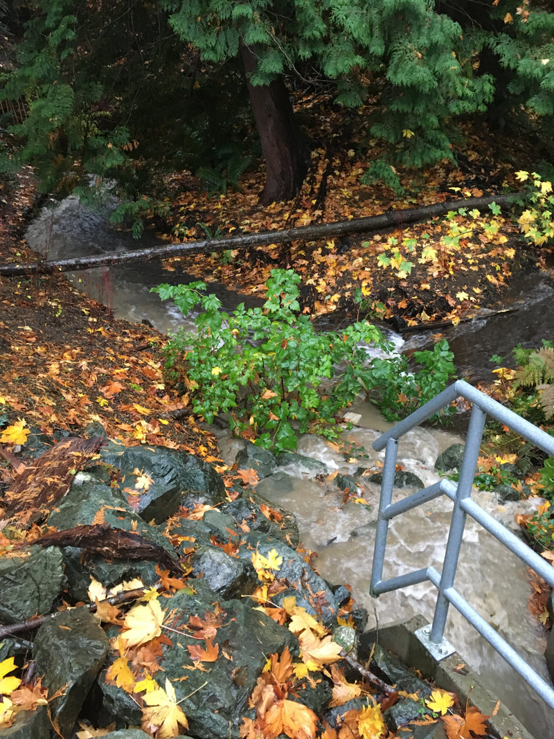 We gratefully acknowledge the Pacific Salmon Foundation for supporting this project.
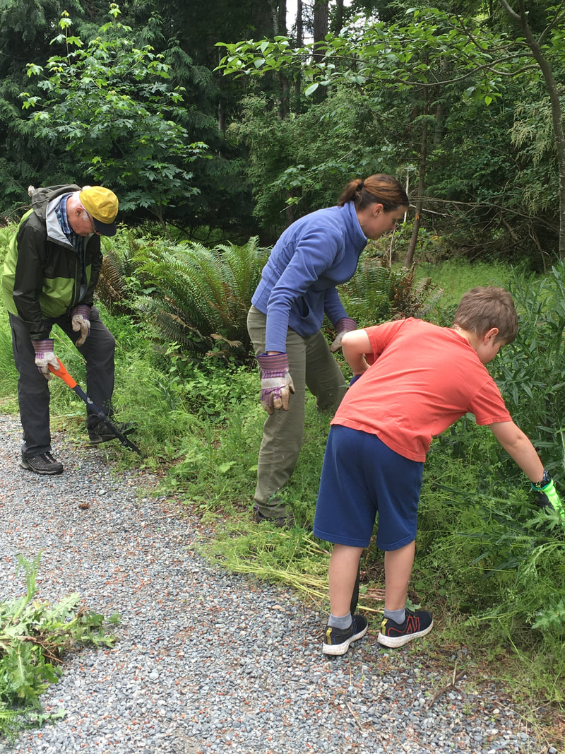
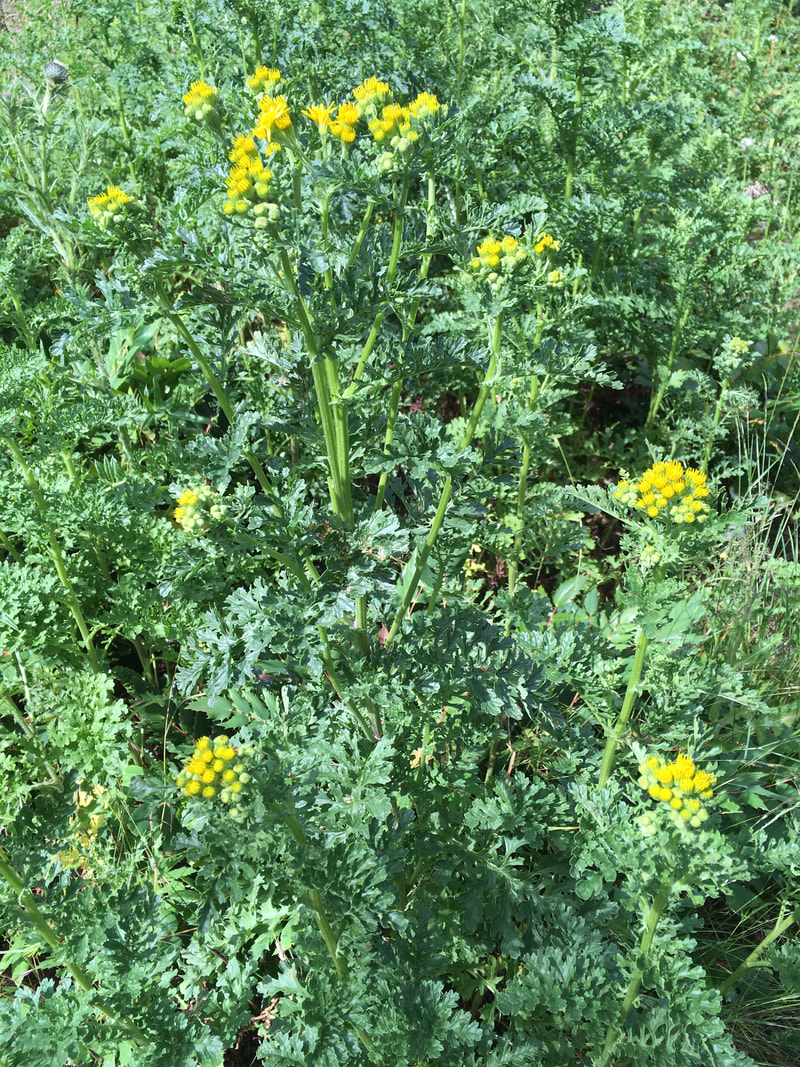
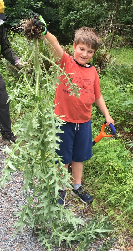
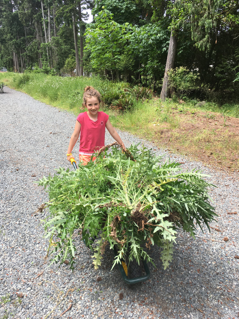
Again this year we deferred our annual invasive removal with Ecole Hammond Bay students, since the public health regulations aren't changing to allow large outdoor gatherings until after June 15. For now, we're working with our small group of volunteers to remove invasive plants in the riparian area between the gravel path and Walley Creek adjacent to Ecole Hammond Bay. Last year we almost eradicated the thistle that had completely overtaken the area. That allowed other invasive plants to thrive, so this year we are tackling Himalayan blackberry, Daphne (Spurge-laurel), English Ivy, and Bur Chervil. (To identify invasive plants in your area check out the Invasive Species Council of BC website.). These plants are competing with native baby Fir, Cedar, Arbutus and Maple trees, and Salal, Oregon grape and Ocean Spray shrubs for space, light and nutrients. Our hope is that this concerted effort will eventually allow the native plants to become established, creating a more biodiverse and healthy riparian ecosystem.
  poster courtesy of Damaris Brisco, learn more
  May 2021, nursery for long-toed salamanders
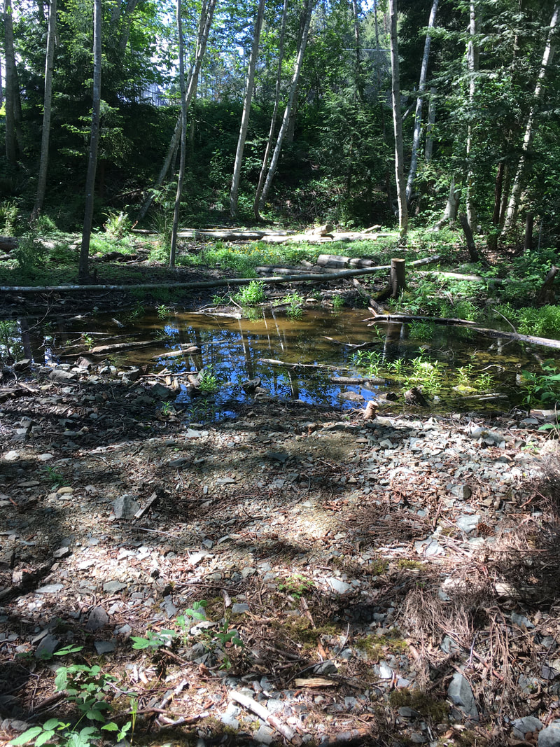
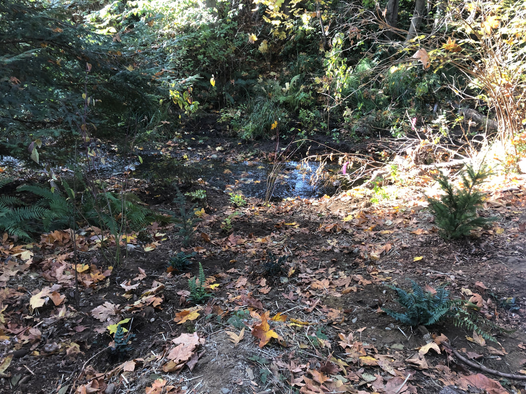
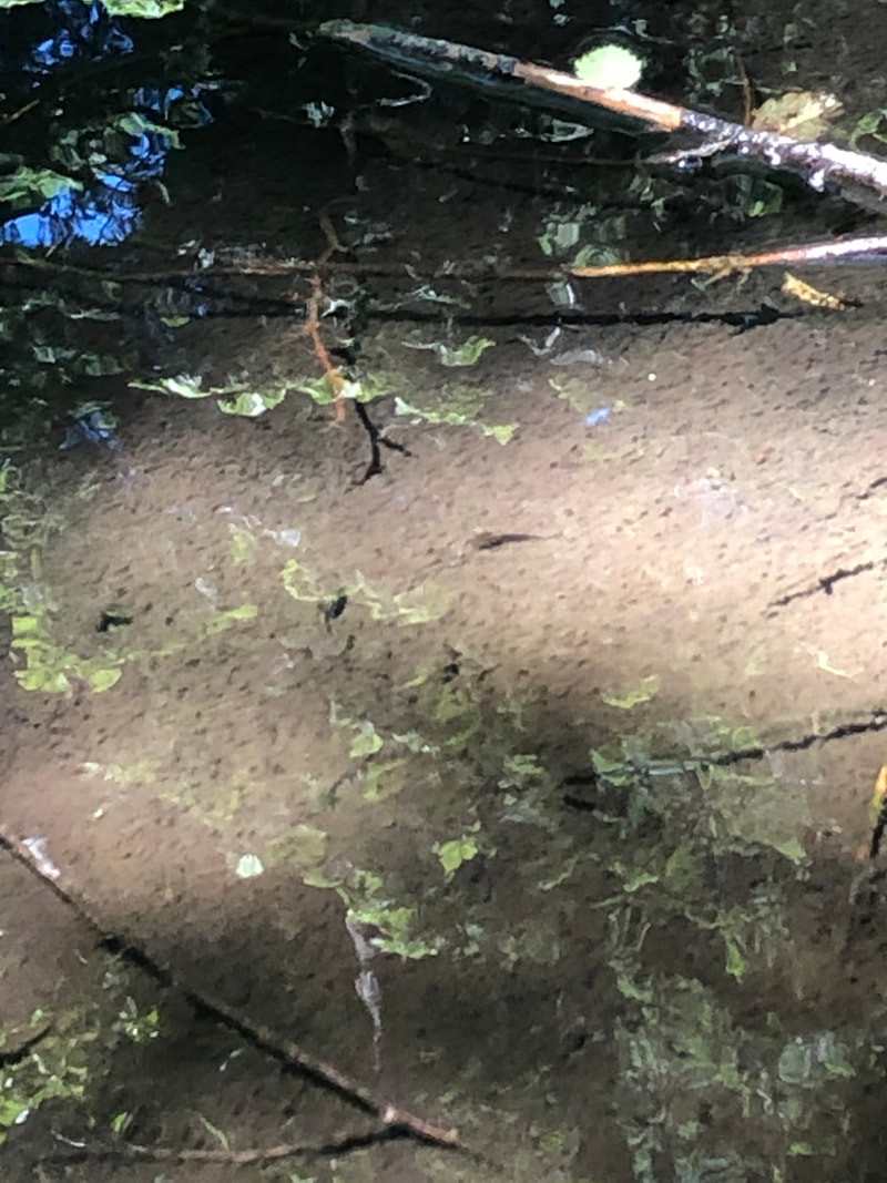
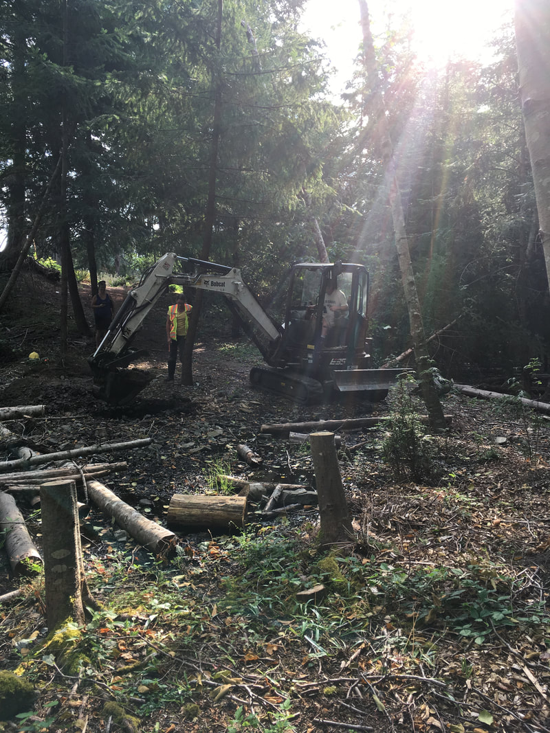
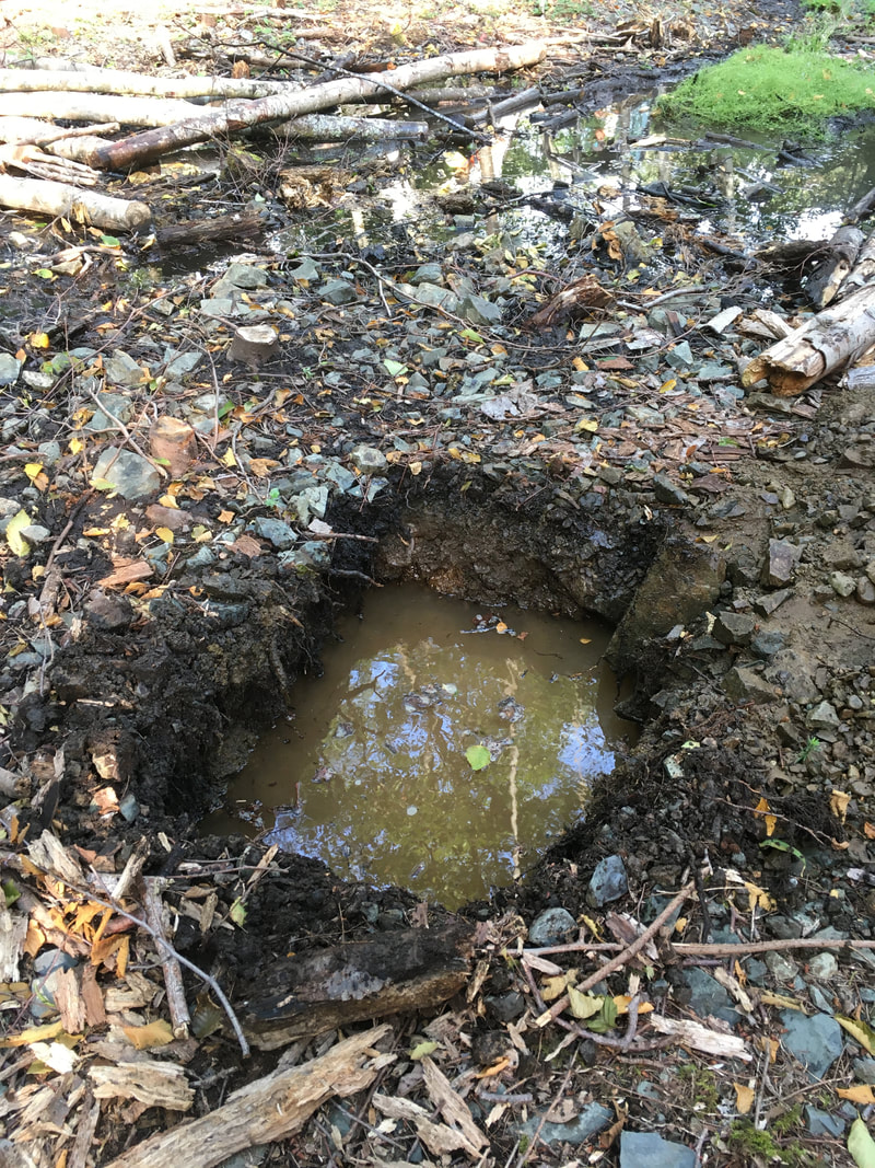
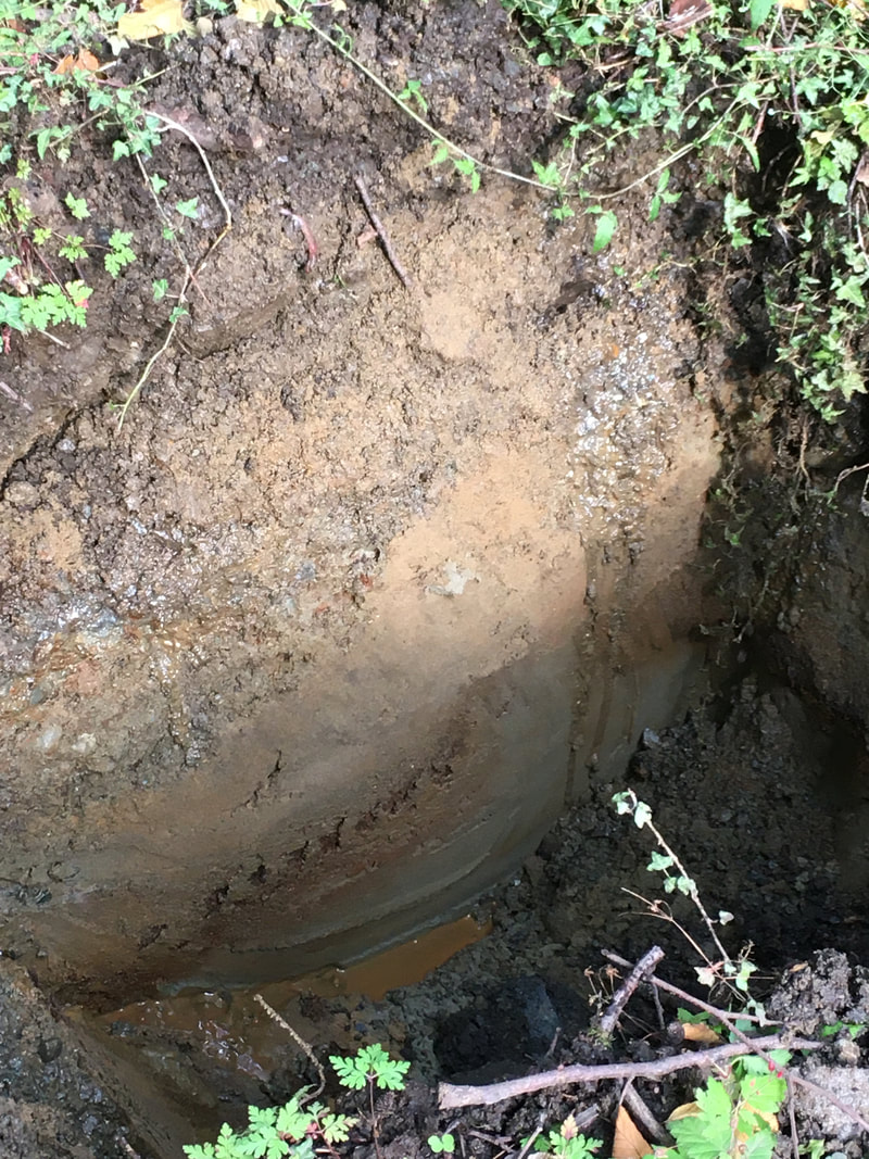
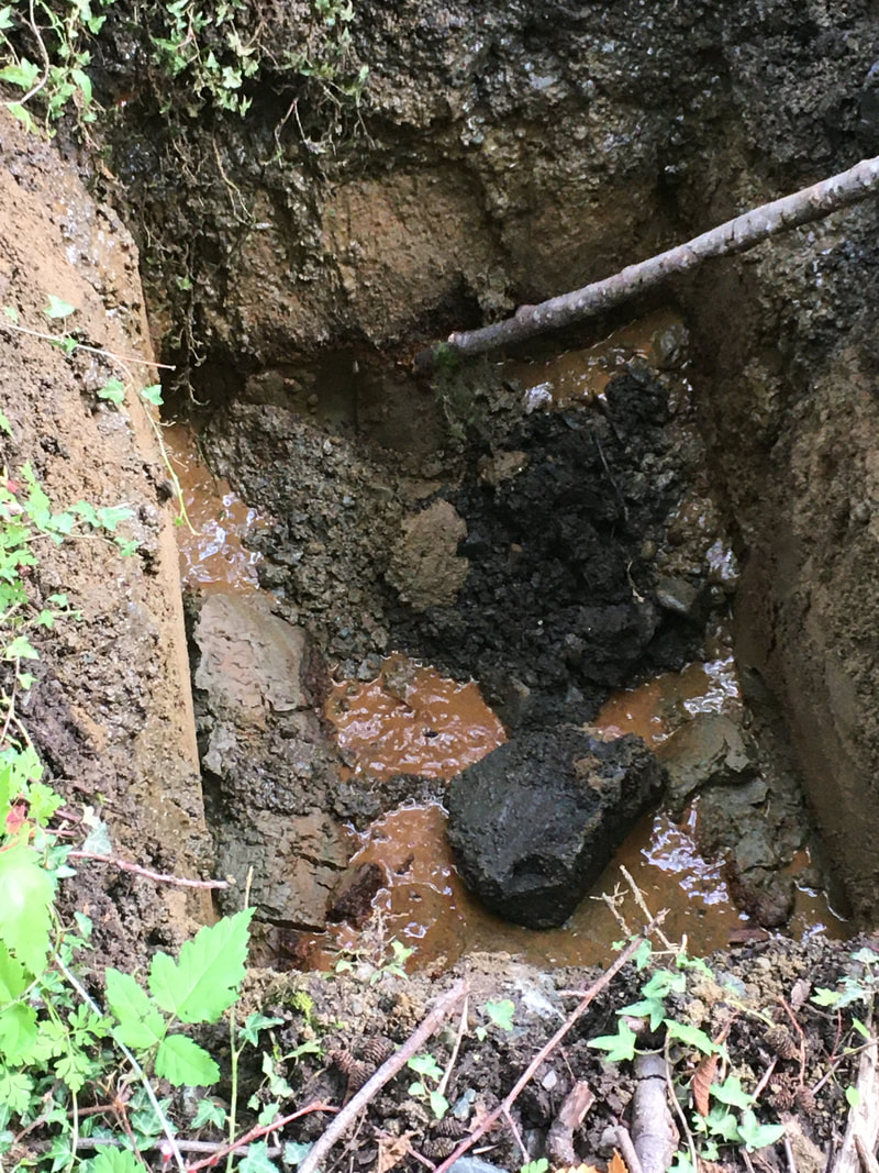
 For the past year, we have worked with the City of Nanaimo to restore the riparian area in reach 2 (read more here). Between the crushed gravel path and the creek there is a shallow pool with some water flowing through it. With help from Elke Wind, herpetologist and wetland specialist, we investigated this area for potential wetland enhancement. The City of Nanaimo generously supplied an excavator and operator (Ryan) to dig test pits so we could examine the underground soil structure and better understand how water moves through this area.
Ryan excavated 5 test pits so we could see if the water flowing through the wetland area is surface water or groundwater. We determined that it is surface water, possibly flowing from the north (ie. Shores Drive access to Neck Point). The pits filled up with water, so after filling the holes back up they were very soft (like quicksand). Ryan placed boulders and logs over top, and we flagged where the pits were. We did not expect the sandy substrate underneath the shale rock on the surface! As far as wetland enhancement - Elke suggested we could put in a pond liner with wetland plants around the periphery, or watch the existing surface water and plan to enhance what's there. Elke's advice either way is to watch the water level and flow before making further plans. 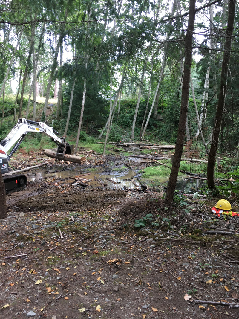 The wetland area after our investigations.
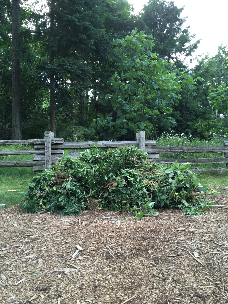
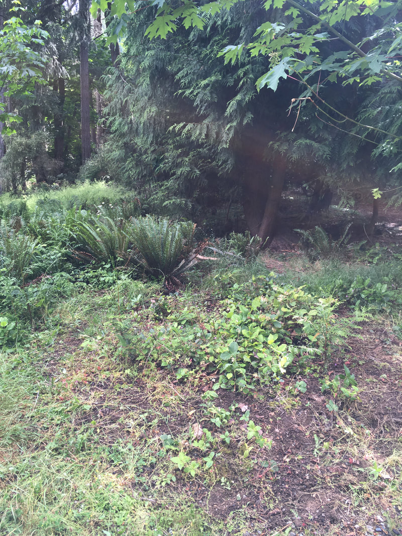
 Our annual invasive removal in Morningside Park looked a little different this year. With schools closed and everyone practicing physical distancing, we relied on a small group of friends and family to tackle invasives in Morningside Park. Thistle, Daphne, and Ivy out-compete native plants like Oregon grape, ocean spray, and tiny fir and Cedar for sunlight and nutrients. By removing as many invasives as possible, we hope to encourage the diverse native plants to thrive. 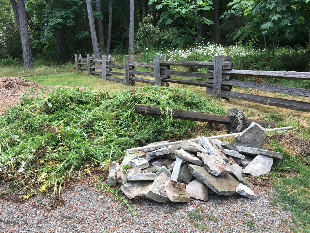 Illegal dumping of yard waste continues to be a problem in Morningside Park. Year after year we discover leaves, grass clipping, and even Christmas trees dumped over people's fences into the sensitive riparian area. Years ago someone broke up an old patio and threw the concrete chunks and fence post footings "away". "Out of sight, out of mind" behaviour degrades the slope stability, causes erosion, smothers native plants that are stabilizing the bank and providing shade, and can crush/impede wildlife. Through talking to residents who back onto the creek, we know that most neighbors understand the importance of properly disposing of yard waste. However, a part of restoration still includes removing materials that have been illegally dumped. We're hoping our continued work and outreach eradicates this problem!
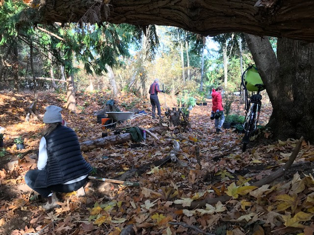
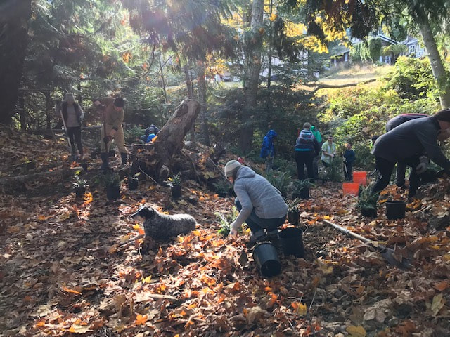
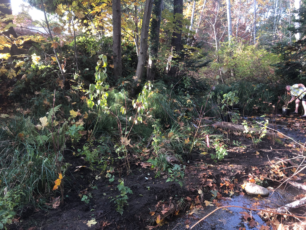
 Project area in Morningside Park BEFORE thinning, January 2018On October 25 Walley Creek Streamkeepers met with Rob Lawrance and Margaret Pimlott from the City of Nanaimo, along with Dave Clough, RPBio, to create a plan for improving the biodiversity in a part of the riparian area in Morningside Park. City arborists then helped thin an unhealthy stand of fir and alder that had self-seeded in an area full of rock fill. This created space for volunteers to plant a variety of native plants to increase the biodiversity of this area, and improve the water-retention qualities of a wetland area adjacent to the creek. 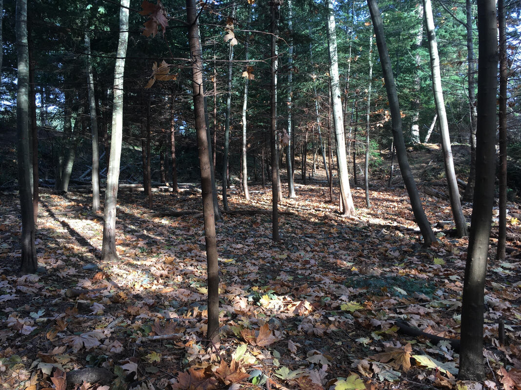 Project area in Morningside Park DURING thinning/before planting, facing the gravel path and Ecole Hammond Bay Elementary.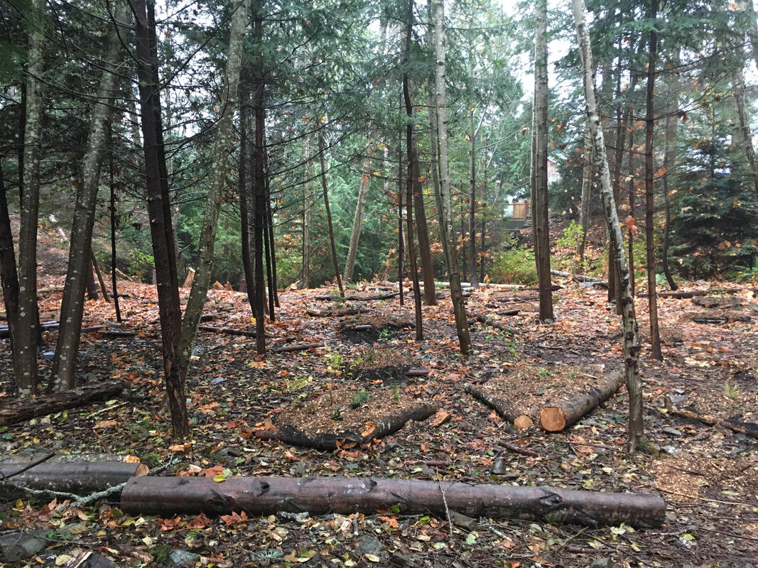 Project area AFTER planting, facing the creek and houses that back onto Walley Creek along Hammond Bay Road.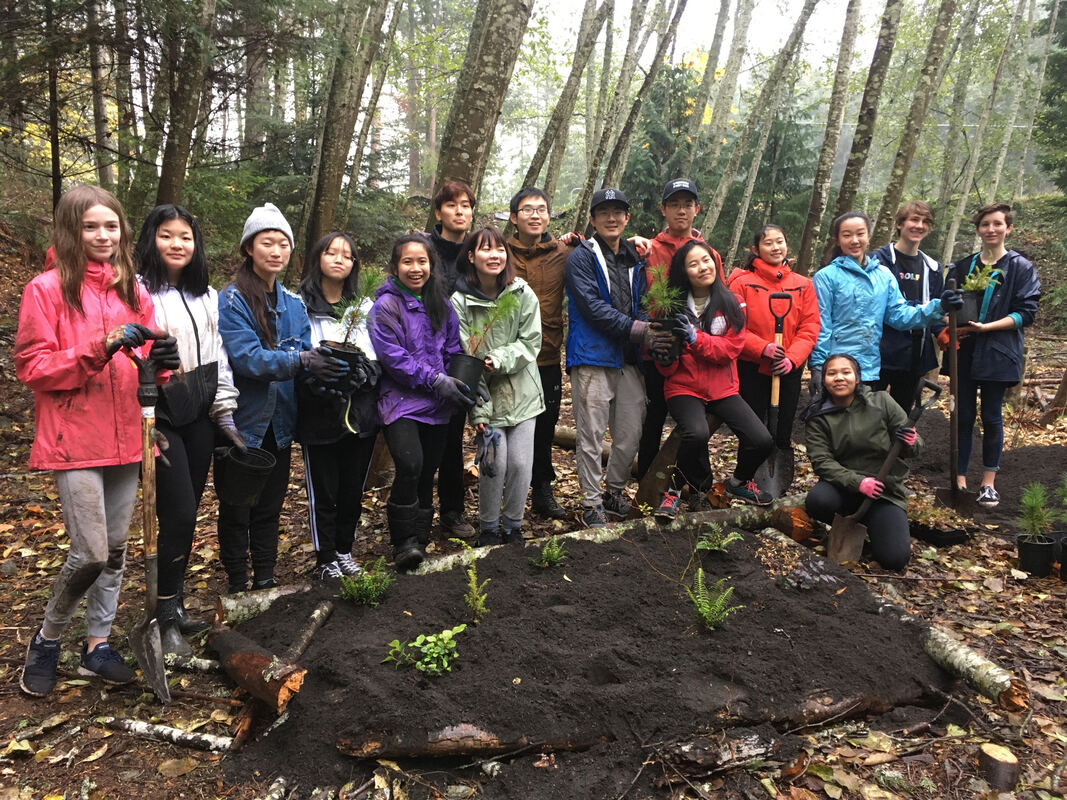 35 volunteers came out November 8, 2019 to help us improve the biodiversity in Morningside Park (Reach 2 of Walley Creek). They created polygons out of logs, moved 15 yards of topsoil and 7 yards of mulch, then planted 260 native plants and trees including snowberry, Indian Plum (Oemlaria), swordfern, Oregon grape, Douglas Fir, Western Red Cedar and pine. The day was a great success! High school volunteers from Dover Bay and Nanaimo & District Secondary schools brought energy and enthusiasm to the planting day. Rob Lawrance and Deb Beck from the City of Nanaimo volunteered their time, as well as many volunteers from the Nanaimo & Area Land Trust, Departure Creek Streamkeepers, and Snunuemuxw First Nation. We are so grateful to all the volunteers that came out and gave time, energy and expertise to this project! 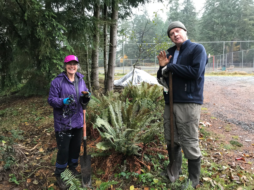 Each week since June we've been carefully watering the Oregon grape, ferns, Nootka rose, Snowberry, and Salmonberry that were planted in the riparian area back in March. We are careful not to let any treated "tap" water enter the creek, but volunteers soak the mulch and soil enough that the plants have a chance to get established this spring/summer. We have also spent many hours pulling invasive thistles along the gravel path. This area was disturbed in 2015 when the RDN upgraded the wastewater outfall at Morningside Drive. The City then replanted both sides of the path and installed an irrigation system to support Maple trees, Salal, Oregon grape and ferns until they were established. The irrigation system is no longer being used, and the native plants are being choked out by opportunistic weeds. While we focus on the riparian area and salmon habitat, we recognize the importance of this park land as a corridor and habitat for many other animals. This is one of many tasks we take on in this "adopted" park.
|
Categories
All
Archives
March 2024
|
|||||||||||||||||||||||||||||||


 RSS Feed
