|
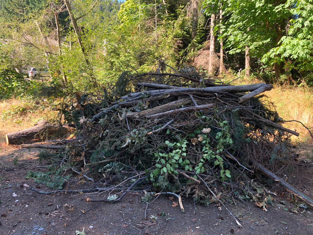
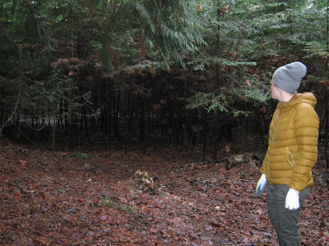
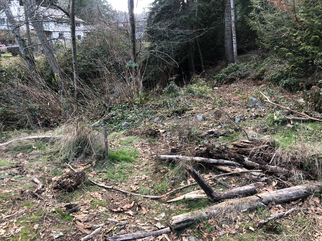
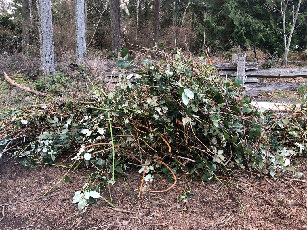
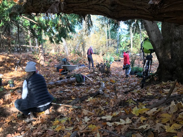
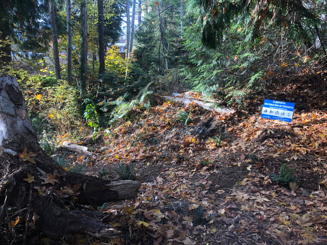
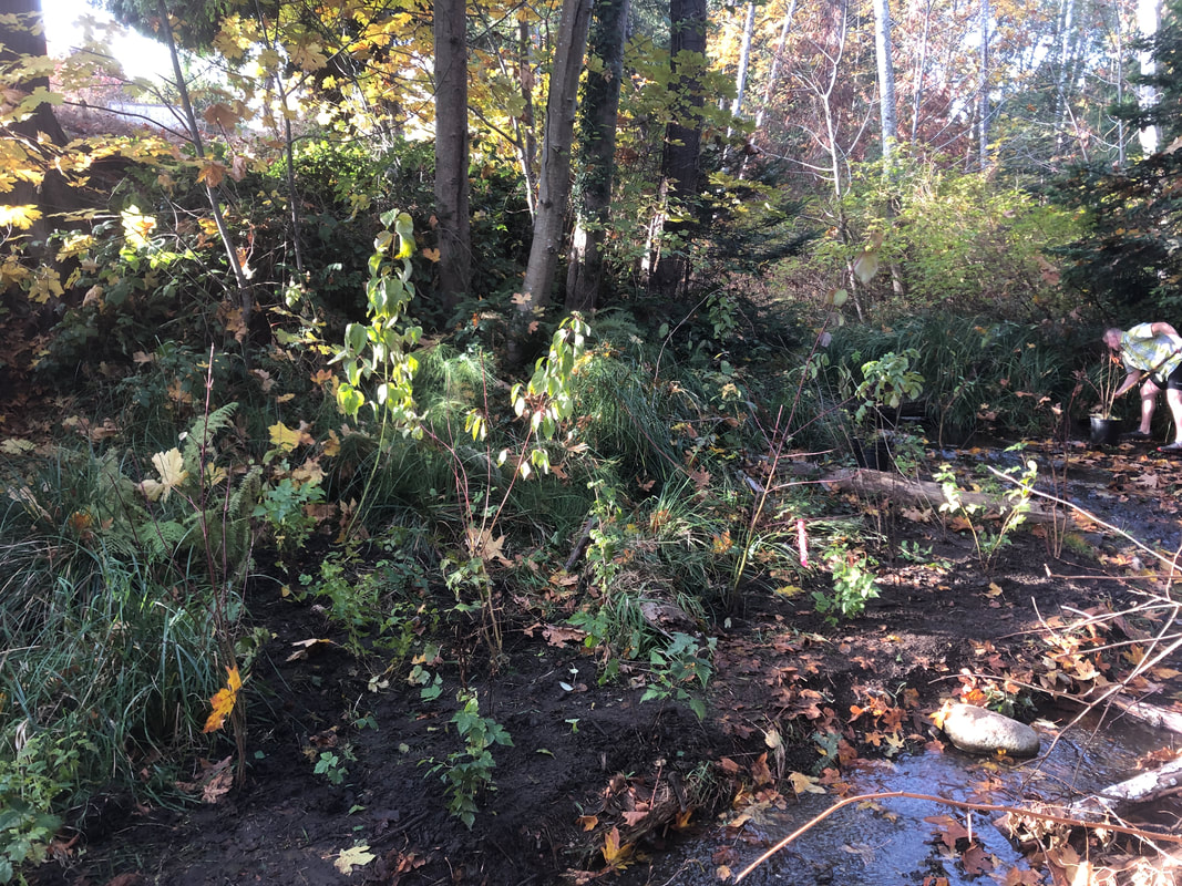
To date, our work removing invasive species has been focused on reach 1 (from the beach at Nina's up to Morningside Drive) and reach 2 (Morningside Park, between Morningside Drive and Shores Drive). Today we made our first foray into reach 3, where the creek flows through the RDN GNPCC property. The mouth of the culvert upstream of Shores Drive is completely overgrown with invasive Himalayan blackberry, as most disturbed, sunny spots are. We used loppers and pickaxes to chop down the canes and dig out the roots, filling a large bin and opening up the space. The plan is to mulch heavily with wood chips and plant quick-growing successional species - red osier dogwood and big leaf maple, followed by later succession species like Cedar and fir, either seeded from local species or planted intentionally. 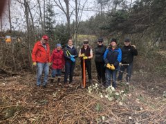 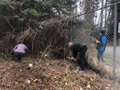
0 Comments
As we reflect on 7 (!) years of restoration work in Walley Creek,
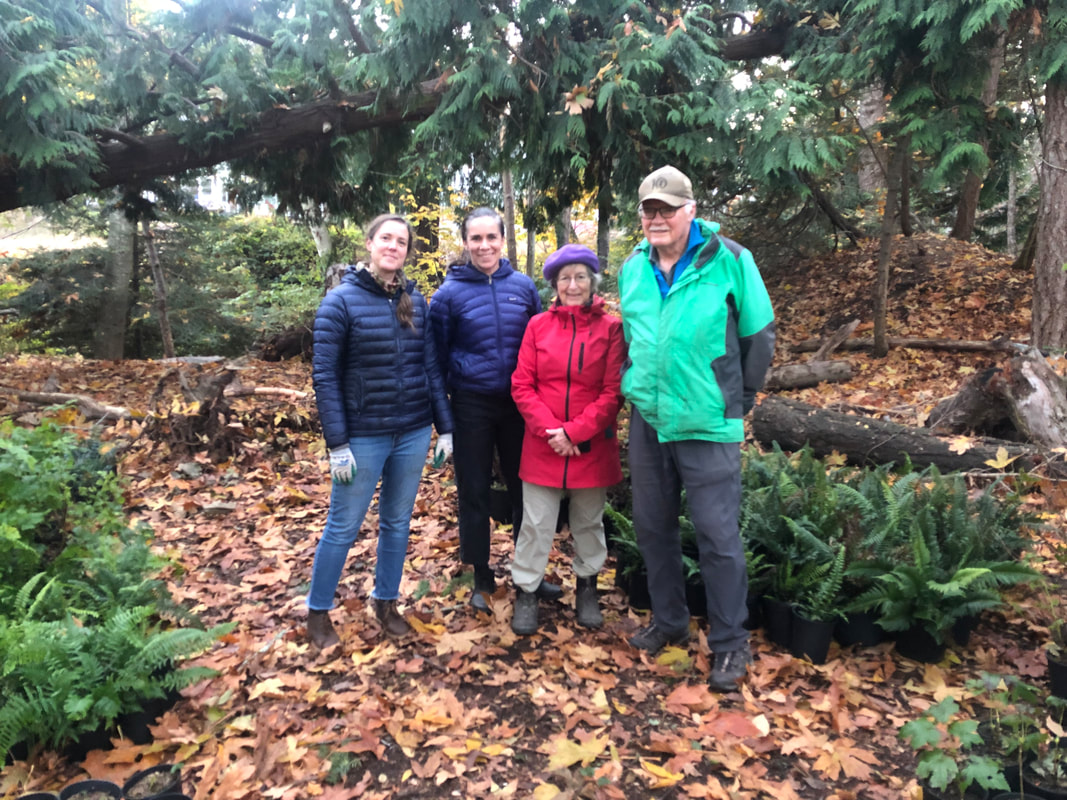
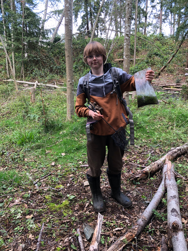
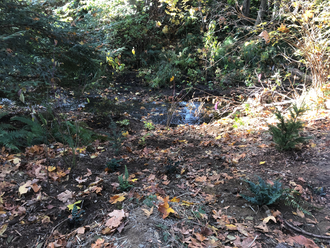
we are looking at priorities for the year ahead. When we began to work on restoration, our primary goal was to understand the creek, its past and current threats and places where it's thriving, and how humans can live more gently with this beautiful watercourse, and even enhance its health and ecological function. Much of our efforts have been focused on salmon, since they are such an important keystone species and receive the bulk of funding and expertise in the stream restoration world. However, we know that Walley Creek may never support a large population of Coho, and setting that as a goal may be ignoring the overall wetland and swamp characteristics of this watershed. We do know that Walley Creek supported resident cutthroat trout, from surveys done as part of the 1994 Fish Habitat Assessment, pg. 11 and 12 and the 1995 Nanaimo Urban Stream Enhancement Study, pg. 27 (see Resources). In the future, we're hoping to work with the Province on better understanding cutthroat trout populations in Walley Creek. These resident species of salmonid are also threatened or endangered in BC streams. When we did our initial stream survey in 2016/2017, we found many trout as we poked around undercut banks. When the creek experienced a disastrous dry spell in 2019, we worried many of the resident cutthroat died. NALT staff and biologists hope to do electrofishing or pit tagging surveys to estimate present cutthroat populations. Walley Creek (and all urban streams) experiences extremely high flows during rain events, and times in the dry season when the stream goes subsurface. These situations are very challenging for fish. They must find refuge in side channels during high flow events, and find pools that are cold and oxygenated enough for them to survive low and no-flow times. In addition, all life in the creek suffers during periods of drought. Going forward we hope to retain water through rain gardens, swales, and increasing the pervious area in the watershed. We also hope to learn from work MVIHES has done on Shelly Creek in Parksville that engaged hydrogeologists in creating a water balance model. A similar tool for Walley Creek would help us mitigate high flows and support the continuous base flows that have characterized this creek from the beginning. So, in 2024 our priorities will be ongoing flow monitoring with support from Provincial hydrologists and the BCCF flo-mo network, and water quality monitoring - RDN CWMN and BCCF 6-PPDQ testing. We will also continue to engage youth and community members in environmental stewardship through invasive removal and riparian protection and revegetation, in Morningside Park with Ecole Hammond Bay students, and with SD68 staff, students and families at the very top of the watershed, where Walley Creek passes Frank J. Ney school. On this gorgeous fall day we set out once again to prevent the bank from eroding where Walley Creek flows behind private residences between Hammond Bay Road and Ecole Hammond Bay. We wonder if this problem was caused by the creek being moved? There is a natural seep that flows from a different direction, past the tennis courts and through the salamander meadow. The erosion is exacerbated by yard waste being thrown over the fence, though all but one neighbor has cleaned up their act. In any case, our goal is healthy fish habitat, and keeping the creek from filling up with silt and soil if there are debris jams and high flows. This design was suggested by Lindsey Haist of Alder Environmental, and it's been very successful so far. Today we reinforced "benches" built in previous years, installed new ones, and planted sword fern and dull Oregon grape, hoping their roots will take hold. We had a strong crew of family (Nina's husband, children and grandchildren, and Linda's husband and children), dedicated volunteers, and recent VIU grads to pull this off in a couple of hours. We were so grateful for a delivery of healthy plants from Streamside to restore the biodiversity of this area. The project was completed with support from the City of Nanaimo Community Watershed Restoration grant, project management and volunteer coordination in partnership with the Nanaimo & Area Land Trust, of which Walley Creek Streamkeepers is a committee. There happened to be an interpretive tour of the salamander monitoring project in this area led by Elke Wind at the same time that we were working! The group found three dead naked mole rats, that could have been victims of rat poison?? We also encountered some very angry wasps, who are cranky during this fall season and took it out on a couple of volunteers, ouch! 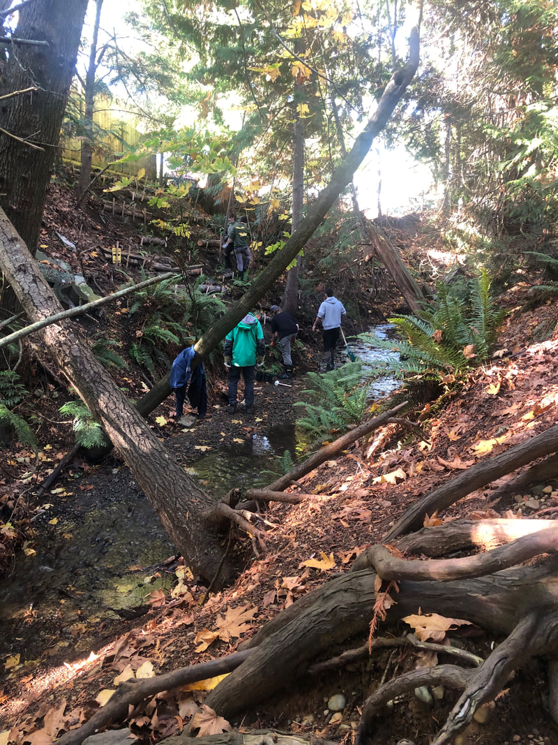 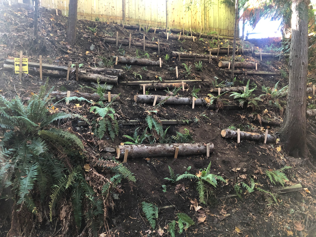 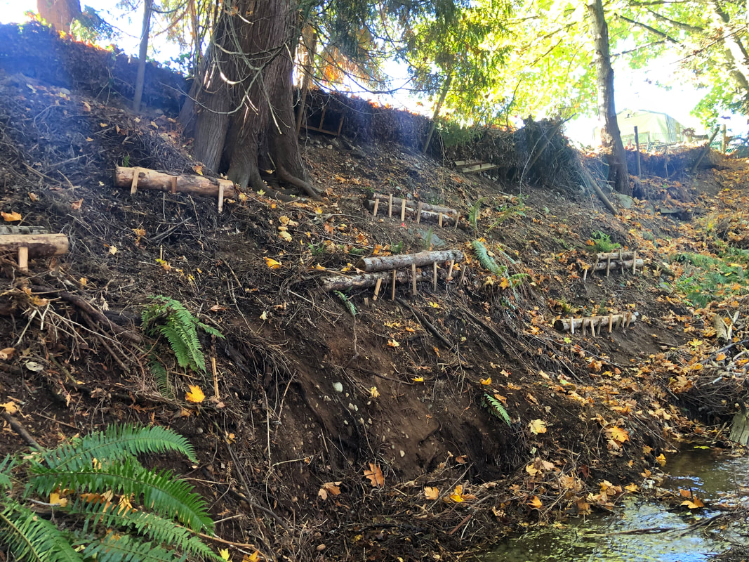 We've been collecting measurements of Walley Creek flow since August 2019, when we saw the creek go completely dry for the first time in known history. We're working with the BCCF Flow Monitoring Network (Flo Mo) to get our data up to "grade C" as far as Resources Information Standards Committee (RISC) standards. This will involve continuing to use the Flowtracker at least 6 times/year during high flow, continuing to collect level logger measurements at least 4 times/year, and using flumes as well as photographic evidence during low flow or dry events. The Standard Operating Procedures Manual and data sheets are available on the resources section of the BCCF Community Flow Monitoring Network website. Collecting data is a very technical process, involving expensive equipment that is often shared between organizations and doesn't always work the way it's supposed to. Interpreting the data involves comparing the measurements against rainfall amount, barometric pressure, and creek size/shape. Then there's the challenge of reflecting on the information in a way that's meaningful to the people who want to understand it for decision making. As NALT staff continue to collect flow measurements on Walley Creek, we'll work towards maintaining the flume at the RDN GNPCC. The BCCF is supporting us to add a Flo Mo monitoring station in 2024. We really want to know and understand the flows on Walley Creek. At its lowest flow there are sections that go subsurface just above Shores Drive, while on October 18, 2023 we recorded 130 L/second in Reach 1. Its highest flow was taken November 15, 2021 at 300L/second!! Our goal is to work with City storm water managers to mitigate impacts on fish and other life in and around Walley Creek. 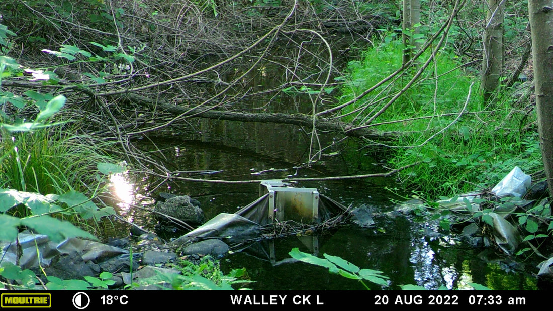 August 2022 - the whole summer was more or less at this level, with a few surges from summer rain 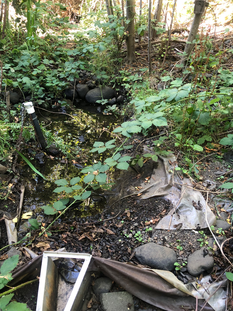 August 2023 - because of very low rainfall spring and summer 2023 there was no surface water in Walley Creek where it's been diverted to flow through a liner on the GNPCC property.
We have initiated a project with Frank J Ney school (upper reaches of Walley Creek) that would take place over three or more years, where we'd invite students and families of the elementary school to get involved with invasive species removal and finding a balance between children accessing the area for exploration and learning while encouraging ecological health. Module 8 of the Streamkeepers handbook is all about preventing domestic animals from having unlimited access to the stream. We sometimes joking refer to the children that play in the riparian area as livestock, but the truth is they can have a very serious negative impact on the plant community by unknowingly trampling everything while engaged in their busy imaginative and construction play. One teacher had the brilliant idea of telling the children that it hurts the trees when their "toes" (exposed roots) get stepped on. After a year of reminding the children, there are now ferns and salmonberry bushes growing up in between the trees "toes" in this place between the school and the creek. An important goal of our Streamkeepers group is providing opportunities for young people and their families to connect to nature, and enjoy the mental health benefits of time outdoors, especially in creative or community-minded endeavors. While we want to limit the children's access to the streambed (to protect aquatic invertebrates, salamanders, frogs, and fish) we want them to KNOW this place and learn with and from its seasonal cycles. We look forward to beginning this project with the school, as a learning opportunity, community building endeavor, and ecological restoration project. 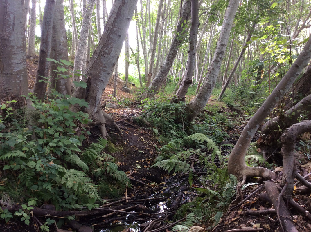 
aerial photo of Frank J Ney Elementary and adjacent green space
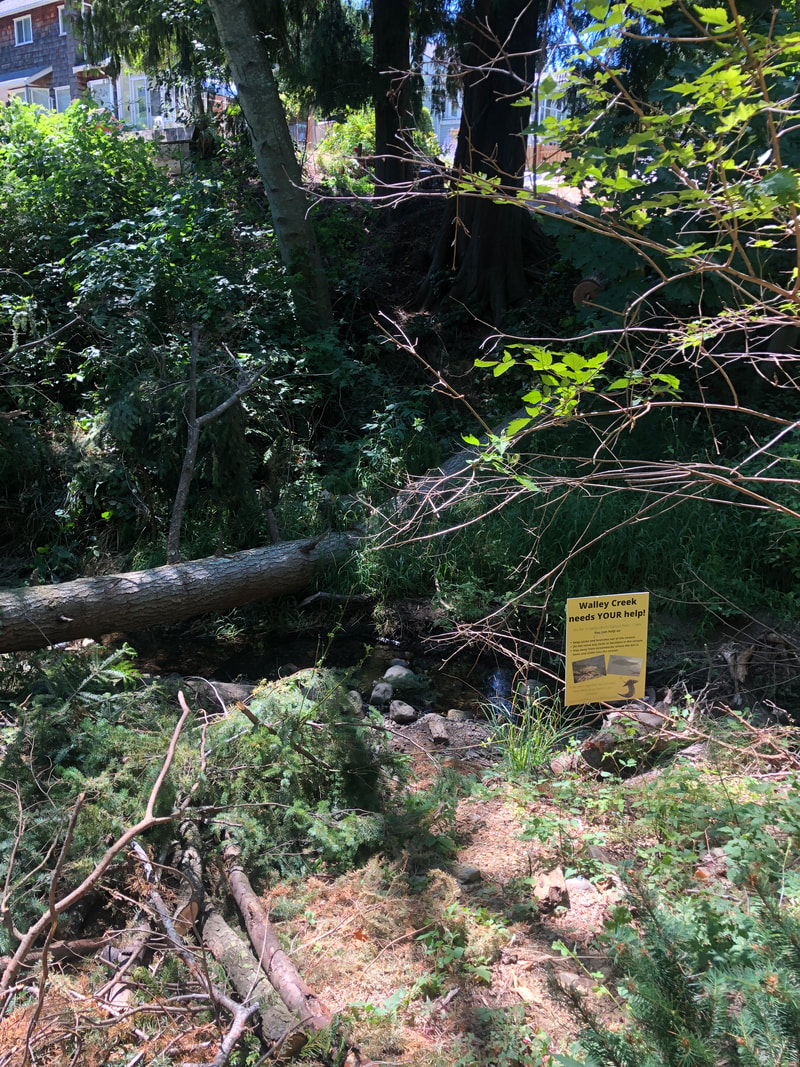
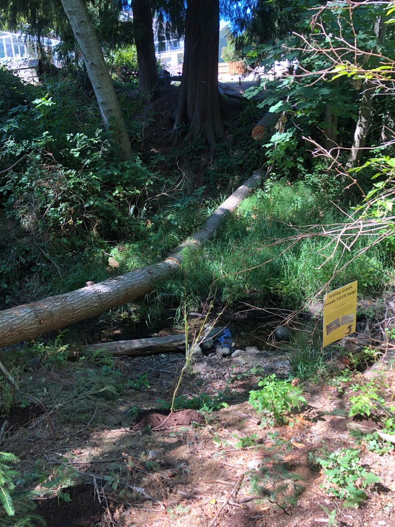
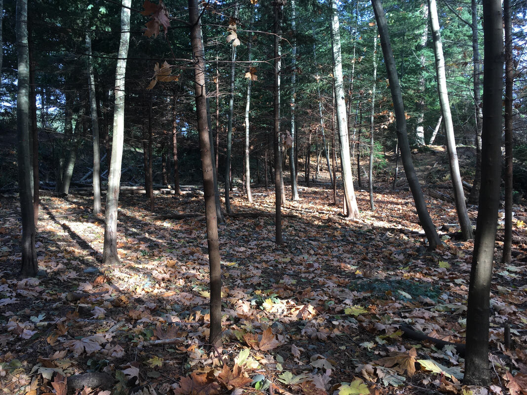
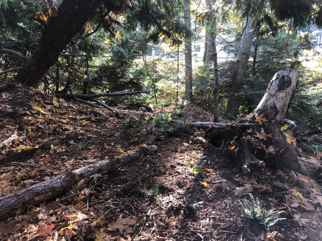
A tree came down across the creek several weeks ago, taking down the top of another tree and leaving a big mess in its wake. Unfortunately the branches and tree trunk squashed many of the plants from our fall planting project! A small group of hardworking volunteers worked to remove the branches, leaving a log which will provide shade and hopefully stabilize the bank. There are many trees remaining in this narrow corridor that are dead or dying. This area continues to struggle from drought, and erosion in the riparian area.
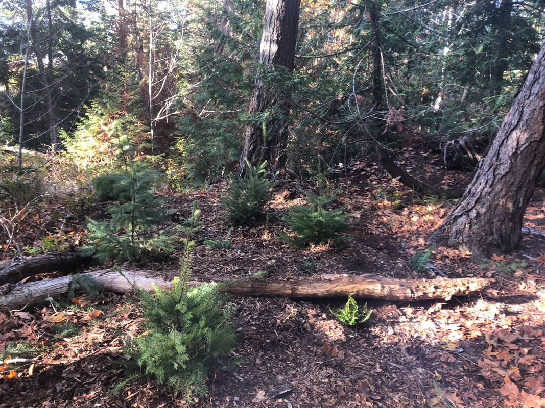
Our group has a nice rhythm of spring/summer invasive removal and fall planting. This has the goal of increasing biodiversity, stabilizing the stream banks to prevent erosion, and restoring the plant communities that were here pre-disturbance.
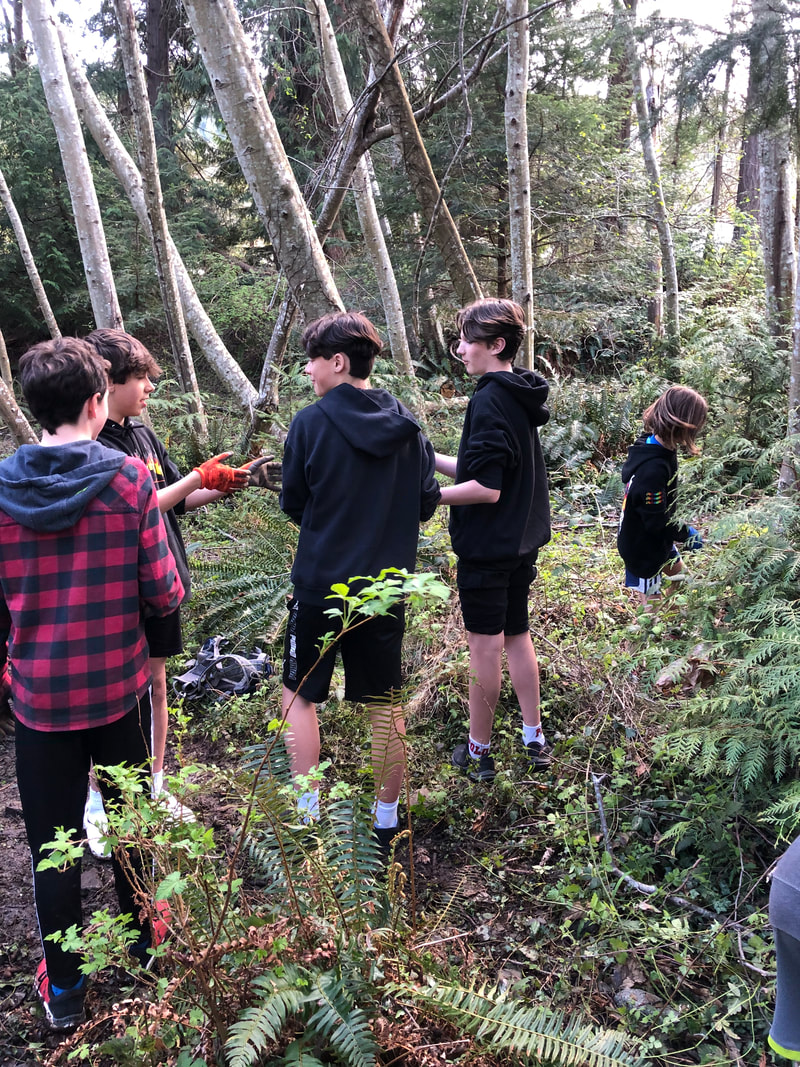
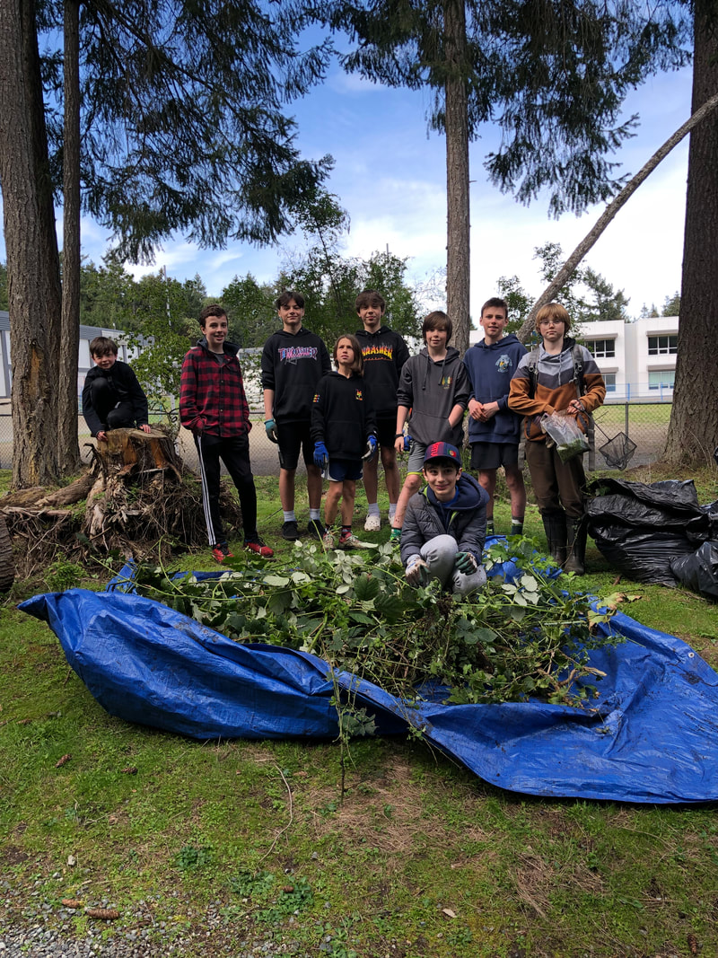
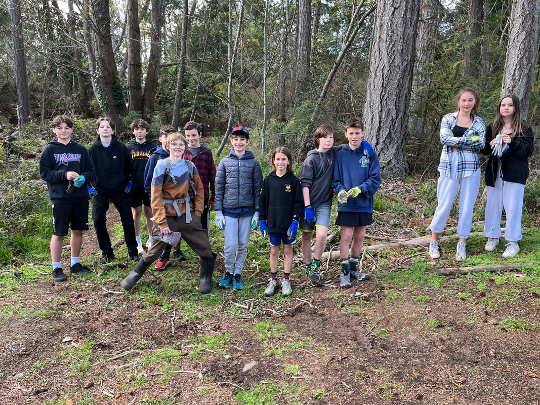
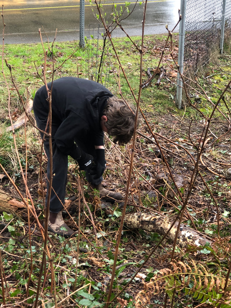
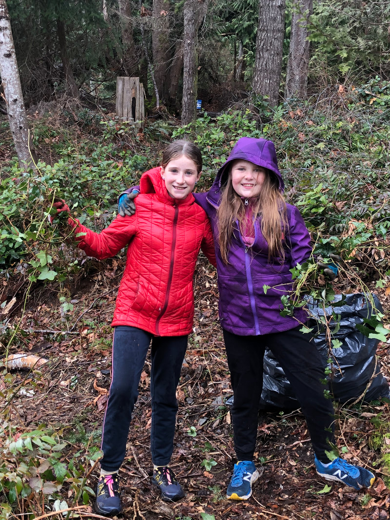
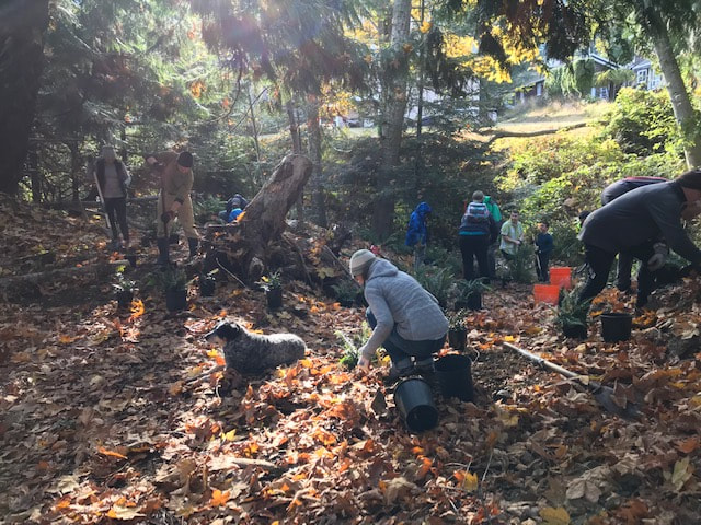
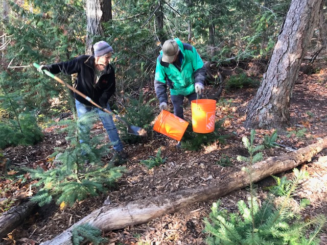
We are learning that it's not as simple as putting plants in the ground. Despite best efforts at placement, some plants get trampled, browsed by deer, suffer from summer drought, or don't make it for unknown reasons. We've learned that ferns and Oregon grape are nearly indestructible, though they haven't survived well on the steep slope stabilization projects. The key seems to be considering which plants need "wet feet" - salmon berry and Cedar, for example, and which ones can tolerate drier conditions - snow berry and pine. Then adding lots and lots of bark mulch and wood chips to hold onto moisture and nutrients in our dry summers. Even still, not all the plants survive. We keep planting densely, using chicken wire and Plantskydd to deter the deer, and repeating planting as we assess what's surviving. It makes us grateful for the established trees that are there, and appreciate the truth in the saying, "The best time to plant a tree is 20 years ago. The second best time is now." This year we were helped by a hard working, hilarious crew! Most of the volunteers also play basketball together at school. They joked and laughed together while they worked. I loved the “blackberry brigade” they figured out! Clearly they are used to working as a team. We focused on removing invasives from the area adjacent to the "salamander meadow", since there were nesting songbirds in the area adjacent to the gravel path. Volunteers hauled out four bags of English Ivy and a huge pile of Himalayan blackberry. Best of all we heard a woodpecker and lots of song sparrows, and saw the red backed salamanders that are so unique to that little wetland.
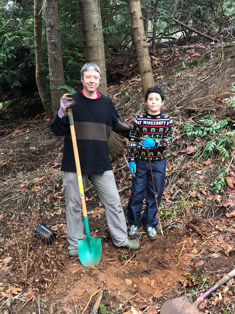
Over Spring Break we worked hard to cut back Himalayan blackberry along the streamside and and dig out the tenacious knuckles left behind. While a small excavator can be helpful with this work, we used loppers and shovels so as not to disturb the native thimbleberry plants interspersed with the Himalayan blackberry. There is also a lovely carpet of native trailing blackberry in this area that we tried to gently move aside during this work. A huge thanks to NALT volunteers who helped with this physically demanding task. Also, Bruce dug Daphne while the kids bagged ivy.
In November 2022 we planted over 250 plants from Streamside Native Plants over several days with the help of over 20 volunteers recruited through NALT, as well as a group of students from Ecole Hammond Bay. In February 2023 a small group got the last few plants in the ground!
 |
Categories
All
Archives
March 2024
|
|||||||||||||||||||||||||
 RSS Feed
